Hurricane center lowers chance Gulf system will develop, but rain coming to Florida
ORLANDO, Fla. — The National Hurricane Center lowered its prediction the season’s next tropical depression or storm would form in the Gulf of Mexico, but Florida is likely to get heavy rain next week whether it develops or not.
As of the NHC’s 8 a.m. tropical outlook, a surface trough located over portions of the Gulf with disorganized showers and thunderstorms is likely to form into an area of low pressure this weekend or early next week.
“Subsequent tropical or subtropical development could be limited by the system’s potential interaction with a frontal boundary,” forecasters said. “Regardless of development, locally heavy rains could occur over portions of Mexico during the next few days and over portions of the Florida Peninsula next week.”
The NHC lowered the chances to just 30% that it could develop in the next seven days.
Meteorologist Brendan Schaper with the National Weather Service in Melbourne said the Florida peninsula is likely to see deep moisture.
“This will result in more cloud cover, higher coverage of rain, and a few lightning storms,” he said. “Instability does not appear as impressivethrough the extended period … However, the threat of heavy rain and instances of localized flooding are expected to increase nextweek.”
The Weather Prediction Center has put both Central and South Florida in a marginal risk for excessive rainfall on Monday.
Heavy rain could continue into Tuesday and beyond.
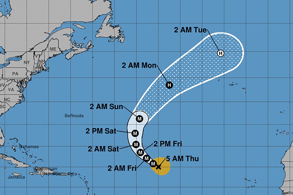
The NHC is also tracking Hurricane Kirk and Tropical Storm Leslie in the Atlantic, but they are not a direct threat to land, although swells from Kirk could reach the U.S. east coast by Sunday with heavy surf and rip currents.
As of 5 a.m., Kirk was located about 1,185 miles east of the northern Leeward Islands moving northwest at 10 mph with maximum sustained winds of 120 mph making it the season’s third major hurricane.
Hurricane-force winds extend out up to 35 miles and tropical-storm-force winds extend out up to 185 miles from its center.
“A turn toward the north and north-northeast at a faster forward speed is forecast over the weekend,” forecasters said. “Kirk is a Category 3 hurricane on the Saffir-Simpson Hurricane Wind Scale. Some strengthening is forecast during the next day or so.”
As of 5 a.m., Leslie was located about 515 miles southwest of the southernmost Cape Verde Islands moving west at 6 mph with maximum sustained winds of 40 mph. Tropical-storm-force winds extend out up to 60 miles from its center.
“A slow westward motion is expected through tonight, followed by a slightly faster west-northwestward motion Friday through Saturday,” forecasters said. “Strengthening is anticipated, and Leslie is forecast to become a hurricane in a couple of days.”
The season so far has 12 named storms including seven hurricanes and five tropical storms.
The season runs from June 1-Nov. 30.