Eastern U.S. bracing for the first winter storm threat of the season

The East Coast has yet to experience a major storm this winter season – but meteorologists are monitoring a potential new pattern that could drive notably stormy weather to the region come January.
Up to this point, a combination of unseasonably mild temperatures, long-term warming and atmospheric patterns more conducive to rain than snow have contributed to a milder season. For some big cities, it’s essentially been a winter storm drought.
It’s been almost three years since New York City, Philadelphia and Boston reported a snow depth of at least 6 inches.
But experts say that trend could soon wane in some spots. The first chance for a storm could come between Jan. 5 and 7.
The coming pattern shift may be “by far the most favorable look we’ve had in years for moderate or even major snowstorms” for the Mid-Atlantic, meteorologist Tomer Burg said.
Forecaster John Homenuk wrote on X that he is “becoming increasingly convinced that the upcoming pattern will be the most favorable we have seen for winter weather in the Northeast U.S. in at least a few years.”
Factors behind snowy potential
Like any recipe, a formidable winter storm has key ingredients – requiring cold air, sufficient moisture and a suitable atmospheric pattern.
The first ingredient, cold air, will be moving into the country during early January, and it looks like it will stick around for a while.
The air mass that will drive the cold change was over Siberia as of Friday but is forecast to arrive in the United States on New Year’s Day. It will spill onto the Eastern Seaboard around Thursday and is expected to remain in place for at least a week.
The eventual location of the cold air will be key.
Frigid air centered too far east could work to suppress moisture and storm activity. This is because the dip in the jet stream – a focal point for storm formation – would be located offshore.
If the chill is located a bit farther to the west, it can enable an air mass clash along the East Coast, providing a runway for storms to develop.
It can also help to scoop up moisture from the Gulf of Mexico, another key ingredient for the most dynamic storms.
Even when the integral elements are present, a storm is not a given. In the case of the eastern storm threat, there might be enough cold air, but moisture could be a missing ingredient – at least initially.
Outlook shrouded in uncertainty
Even if the pattern during early January doesn’t produce a big storm along the East Coast, there’s another chance for stormy conditions in the middle and late part of the month.
If the jet stream dip slides westward, it could allow more moisture to travel up along the Eastern Seaboard, setting the stage for a storm.
“Outside of fast-moving clipper systems, it’s probably not until the second week of January or so that the window will open for wintry weather,” meteorologist Eric Webb said.
If the cold pattern in early January causes a snowpack to develop in the Plains and Upper Midwest, it could act as a natural refrigerator for air that ends up moving into the East – another factor that would support the eventual arrival of a big storm.
It hasn’t been snowy so far
As the waiting game for a snowy pattern continues, snowfall deficits continue to build.
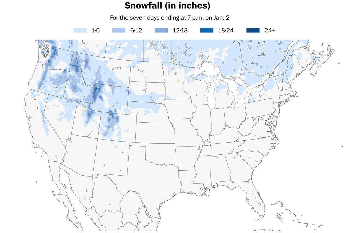
Nationwide snowfall across the United States is 58% of normal as of late December.
It’s the second-least snowy start to the season in at least the past 17 years – only 2023, last year, had less snow at this point.
Only the Great Lakes and interior Northeast, mountains of the Pacific Northwest and southern Rockies have been snowier than normal.
January boosts storm potential
When the coldest month of the year is running colder than normal, it presents a unique opportunity for vigorous storm formation.
A colder-than-normal January in the eastern United States boosts storm potential by increasing baroclinicity, a measure of the clash between cold continental air and warm ocean air.
The colder it gets, the sharper the temperature contrast, providing more energy for coastal storms, called nor’easters. This primes the atmosphere for rapid storm development, fostering stronger winter storms along the coast.
It might be a good time to dig your snow shovel out of storage, just in case.