Cooling off at the West Boulder Meadows in Montana
BILLINGS – With the Main Boulder River south of Big Timber the star attraction for campers, cabin owners, church camps, hikers, anglers and backpackers, its sister valley to the west is somewhat ignored.
Yet the West Boulder River valley has its own appeal.
The valley is bordered to the northwest by a steep band of rock. To the east are fields filled with boulders deposited by glaciers during the last ice age. Looking southwest provides great views up the drainage with the Absaroka Mountains to the right and the West Boulder Plateau to the left.
Unique ownership
Along the drive to the trailhead that adjoins a small Custer Gallatin National Forest campground is a unique development – the West Boulder Reserve. The reserve, according to a Hall and Hall real estate post, was once a dude ranch. Forty years ago, 20 owners divided the property into “what is likely the first ‘shared ranch development.’ ”
Each landowner has a small lot with a building site while the rest of the property is shared. This includes 2.5 miles of the West Boulder River. The property also has an old cabin built in 1885 still standing and seems to be a haven for whitetail deer.
“The concept sold out almost overnight over 40 years ago and it has been notoriously difficult to buy an undeveloped lot there for many years,” the website noted.
The price reflected the land’s unique values, with 15 acres advertised for $975,000.
Mountain goal
Our destination on this warm weekend outing was the trail up the West Boulder River drainage.
The trailhead is located by driving 16 miles south of Big Timber on Highway 298. Then turn right at the sign after crossing the West Fork and drive another 13 miles to the trailhead and campground.
The trail travels through a short section of private property before reaching the Absaroka-Beartooth Wilderness boundary. Our destination was about 3 miles in to a large meadow for some fly fishing and a picnic.
As I hiked in, I made mental notes of all of the gear I had forgotten. This included sandals or fishing waders for braving the clear, painfully cold water. A water purifier would have been a good idea to refill my rapidly depleting supply.
Hot hill
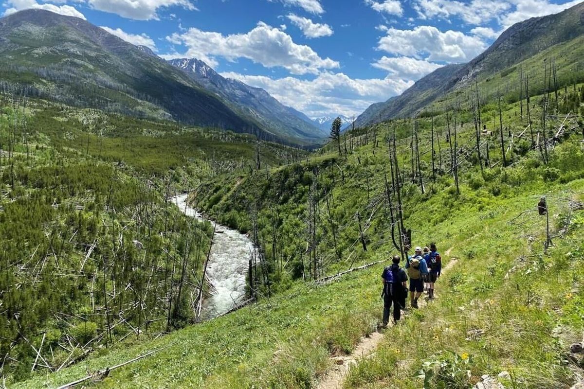
The first portion of the hike travels through large, shady groves of whispering aspen that have regenerated since the 2006 Jungle fire burned more than 31,000 acres in the region. There are still standing dead trees, as well as numerous downfall, but the main trail has been well cleared – at least until the next high winds topple more.
After crossing the West Fork Boulder on a sturdy stock bridge (access to the river here is possible, but the canyon is narrow and steep), the trail switchbacks up the sidehill with little shade and a southern exposure that makes afternoon hiking in this section a sweat fest.
Because of that warmth, large portions of the hillside that would have been filled with bright yellow balsamroot blooms had already vanished and died back. Bunches of purple lupine were looking faded and tattered. But the ninebark bushes were blossoming white along with scattered bunches of fragrant chokecherries.
Going up
The trail starts at an elevation of about 5,500 feet and climbs about 400 feet by the time hikers reach the top of the hillside across the river. This provides an excellent view of the Jungle fire’s expansive burn area. Pine trees have regenerated on the east side of the valley, mostly on the shaded north-facing hillsides. But tree cover is sparse on the western side where the trail wanders, and high limestone cliffs dotted with caves reflect the heat.
It’s about a 200-foot drop down to the meadows and the maddening assault of mosquitoes and flies, but the river has slowed down to a crawl here and resembles a spring creek with its grassy and marshy bank. Red-winged blackbirds and mule deer found the deep vegetation to their liking.
We encountered one large group of backpackers heading out after a quick overnighter, several dayhikers and two horseback riders, but the trail didn’t seem excessively busy. Those who hike on from the meadow can travel another 9 miles down the valley before the trail forks and adventurers have to decide whether to climb into the Absaroka Mountains or continue south toward the West Boulder Plateau.
By this time, the trail has gained roughly 900 feet, but for those turning away from the valley it’s a steep climb to the top of the 9,400-foot-high passes.
Meadows
In contrast to the heat of the day the West Boulder was achingly cold. My attempt to fish without waders was like sticking my feet in a cooler full of ice water. The stream was clear, so it was easy to spook fish hiding under the cut banks.
After a few casts with nothing rising I ventured down the trail to the next drainage at Basin Creek. By this point, the meadow had halted, the brush grown dense and a wet stream crossing was necessary because there was no bridge. That was motivation for me to stop, wet my head, hat and a bandana in the cool stream and start the hike back as 80-degree weather soaked my shoulders.
Because of the heat, it was a perfect outing to reacquaint my muscles and memory with the beauty and the beast of hiking this 6-mile round trip.