Smoke, hot weather expected to leave Spokane area this weekend

Record-breaking high temperatures are expected to continue Saturday with a high of 90 degrees, but the wildfire smoke seen the last couple days should start to dissipate, according to the National Weather Service Spokane.
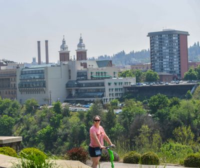
The smoke from Canadian wildfires brought the air quality index into the moderate range Friday, but a change in wind patterns will bring “noticeable improvement” by Saturday afternoon, in time for the Spokane Lilac Festival’s Armed Forces Torchlight Parade Saturday night in downtown Spokane, according to the Spokane Regional Clean Air Agency.
“The arrival of a cold front on Sunday will produce increasing clouds with a chance of showers and thunderstorms, followed by breezy gusting winds and much cooler temperatures on Monday,” the agency’s website said.
Smoke and poor ventilation could keep air quality in the moderate range Saturday, but changing conditions and improved ventilation should return air quality to the “good” range Sunday.
The 87-degree temperature at 5 p.m. Friday at the Spokane International Airport already exceeded the previous May 19 record of 85 degrees, according to Ken Daniel, meteorologist at the weather service. He said the temperature may have increased a bit more after 5 p.m.
The hot weather will continue Saturday with a forecasted high of 90 at the airport, which would set another daily record, Daniel said.
He said showers and thunderstorms are possible Saturday night into Sunday morning in the Spokane and Coeur d’Alene area. Temperatures will start to dip a bit Sunday, with highs in the low 80s, then drop drastically Monday with highs around 70.