Weathercatch: Hail? No, it’s graupel!

Mother Nature delivered the whole shebang last weekend.
Dense energy in the upper atmosphere tracked across the Inland Northwest, generating what sometimes seemed like moment-to-moment weather changes: Sporadic bursts of rain, snow showers, gusty winds, isolated thunder claps and even sunshine coexisting with dark clouds.
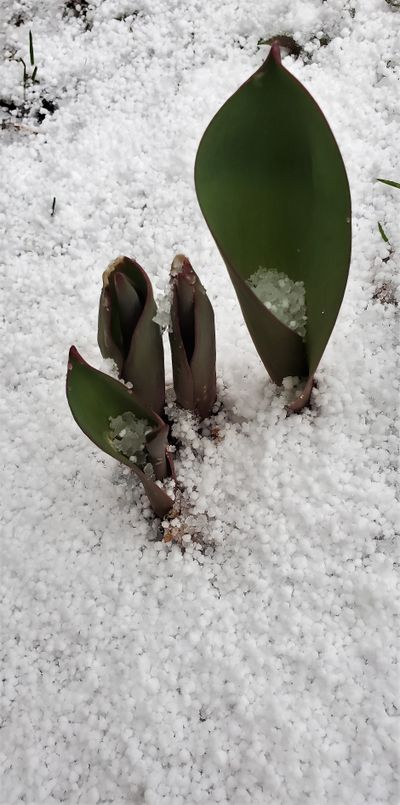
But the biggest attention-grabber was the oddball precipitation known as graupel. It’s not common in our region, so you might not have seen or even heard of it until recently. Milky white balls the size of beanbag pellets tumbled from the sky to cover lawns, parked cars and spring’s emerging flowers.
Not clear like sleet, solid like hail or delicate like snowflakes, graupel pellets are opaque and more on the mushy side.
Graupel – pronounced GRAH-pull – is more common in high-elevation regions. So why did it fall in Spokane, the Palouse and other parts of the Inland Northwest in multiple bursts last weekend? (Perhaps to return next week. Read on.)
A storm system moved through the area when the high-altitude air was very cold and temperatures near the ground were relatively mild. Snowflakes moving through clouds collided with a layer of super-cooled water droplets. In a process called riming, the tiny rain droplets attached and froze around the snowflakes, enabling them to grow into tiny snowballs coated with ice crystals.
If you squeeze graupel between your fingertips, it will crumble. That’s because inside the outer crust of ice is a mound of soft snow. Somewhat like the chocolate center of a Tootsie Roll Pop.
Late winter and early spring is when graupel is most likely to form as the sun becomes stronger but the air aloft remains very cold. The pellets’ soft, wet texture makes them less damaging than hail stones, but they can accumulate and make roadways slick. In mountainous areas, graupel can trigger wet slab avalanches.
Whether graupel fell in your locale during the first weekend of April, the atmosphere behaved like an untamed beast.
Fortunately, conditions are expected to be less volatile this Easter weekend, but still unsettled with a chance of rain showers. More graupel may fall early next week with the arrival of another storm system that will lower our springtime temperatures once again.
Nic Loyd is a meteorologist in Washington state. Linda Weiford is a writer in Moscow, Idaho, who’s also a weather geek.