Monday’s snow makes way for colder temperatures
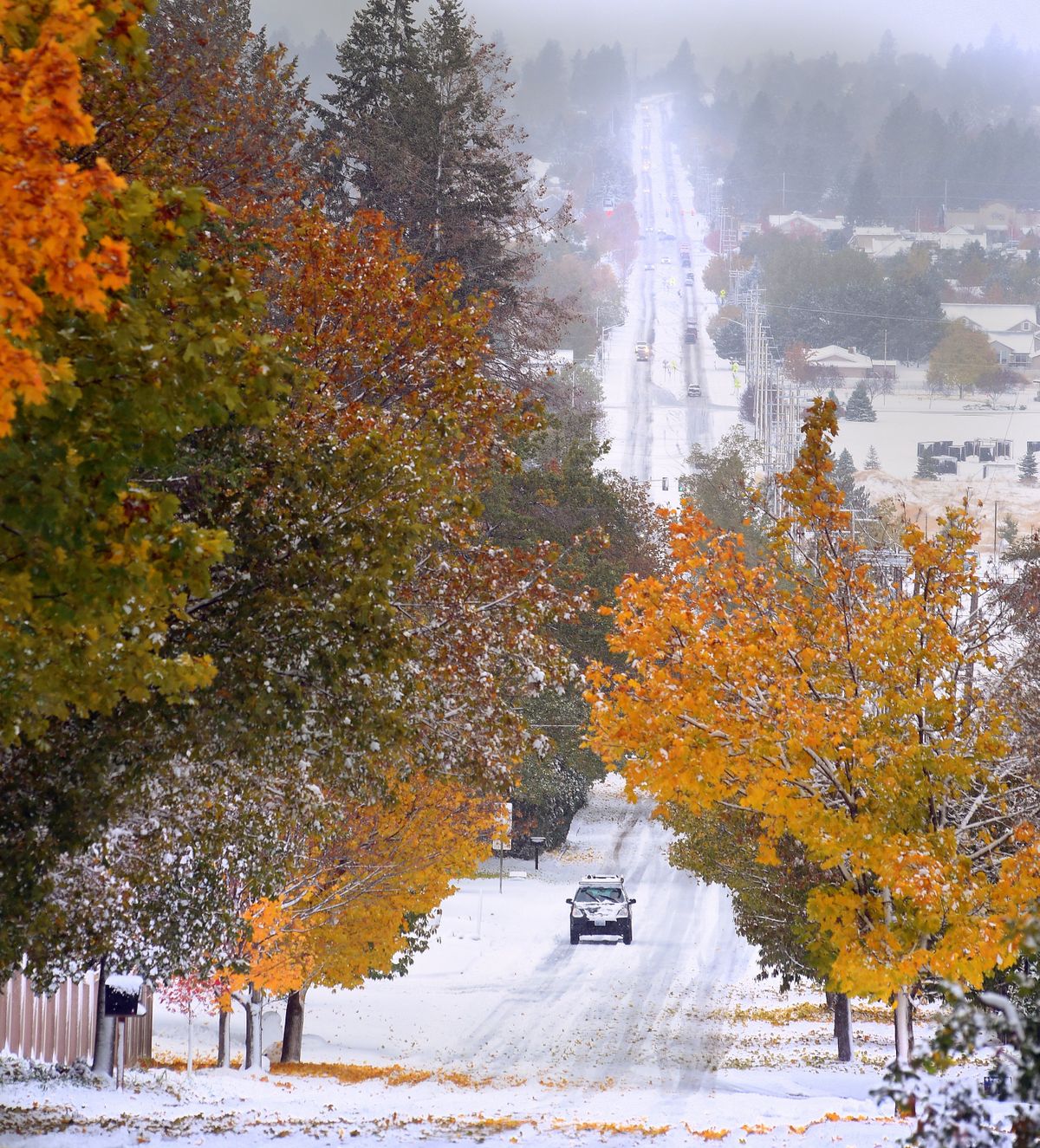
The blanket of snow covering much of the Inland Northwest that led to icy roads Monday is forecast to linger with cold, dry conditions projected for at least a week.
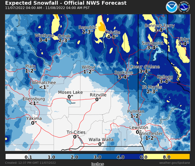
The National Weather Service measured 3.7 inches of snow at the Spokane International Airport, said Greg Koch, weather service meteorologist.
Now the overnight temperatures are poised to fall into the teens for more than a week.
“The snow that we got this morning will probably be the most significant precipitation that we see for the next seven to 10 days,” Koch said.

Spokane city crews plowed the streets Monday, focusing on primary arterials, hills, schools and hospital routes. Crews will work into the neighborhoods throughout the week, said city spokesperson Kirstin Davis. With thawing and refreezing possible, some main roads may need further attention as trucks sand and pretreat them.
Temperatures were expected to drop overnight to 15 degrees Tuesday morning at the airport. With 10-15 mph winds, the windchill could be down to single digits.
Untreated side streets have the potential to refreeze, Koch said, while main roads that were plowed and had a chance to dry out during the afternoon “will probably be just fine throughout tonight and into tomorrow.”
The weather caused multiple accidents across the region, including a multivehicle crash that blocked a northbound lane of U.S. Highway 395 at the Wandermere bridge on Monday afternoon.
There were 46 collisions on state highways and roads in Spokane County as of Monday afternoon, the Washington State Patrol told KHQ. That does not include streets within the city of Spokane.
For the rest of the week, temperatures are expected to range from low teens in the mornings to around 30 degrees in the afternoons. The weekend might bring a slight moderation to the mid-30s Saturday and Sunday.
“We’re not looking for any rapid warm up any time soon,” Koch said.
It is forecasted to be colder than normal across the Lower 48 next week, he added.
Snow depth ranged from about 2-6 inches across the metro area.
The weather service received reports of 1.6 inches on the lower South Hill and 6 inches in the Dishman Hills, Koch said.
Reports were similar in the Coeur d’Alene area, with more snow north of I-90 and at higher elevations. Five inches were reported near Twin Lakes, Idaho and 2.8 inches were reported in southeast Couer d’Alene.
Many school districts announced two-hour delays as a result of the storm.
In Spokane County, Cheney Public Schools and the Liberty, Medical Lake, Reardan-Edwall and Nine Mile School districts announced two-hour delays as a result of road conditions. Many other rural school districts outside Spokane County also announced delays.
Power outages near Kettle Falls
About 2,200 people in the Kettle Falls area were without power between 5:30 and 6:30 a.m. on Monday morning, according to Avista. Power had been restored to all but about 300 by 4 p.m.
There were still 25 active outages in the region, mostly in northern areas, affecting 803 customers Monday evening.
Utility spokesman David Vowels said additional crews from Spokane are responding to help with restorations.
“We will continue to monitor the situation and crews will continue working around the clock until the last customer’s power is restored,” he said.
Vowels also warned to stay clear of downed power lines and to use generators outside.