Snow causes canceled classes and poor road conditions
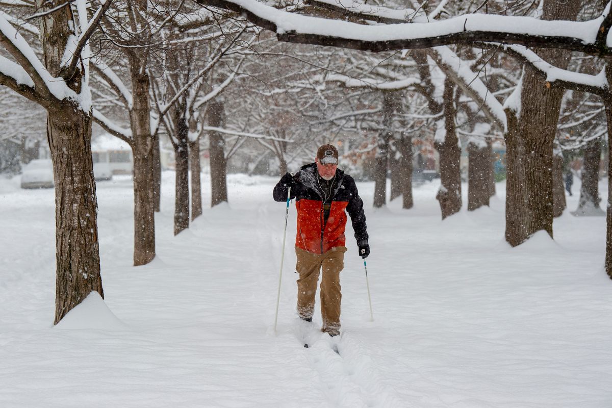
A storm that brought several inches of snow to the Inland Northwest forced multiple schools closures, sealed off mountain passes connecting Eastern and Western Washington, and made for treacherous driving Thursday.
Today, strong winds could bring down tree limbs and cause power outages for residents from North Idaho to Central Washington.
Charlotte Dewey, meteorologist at the National Weather Service in Spokane, said that 5.4 inches fell at the Spokane International Airport by 4 p.m. Thursday, but many locations received more. A reading in Spokane Valley, for instance, totaled 7 inches, she said.
Most school districts in Spokane County canceled classes. But East Valley and Spokane opted to open after a delay.
By the afternoon, the snowstorm lost some of its intensity, although snow still fell sporadically the rest of the day.
The snow transitioned to rain and freezing rain Thursday night, potentially making for “very slick” roads for Friday morning’s commute if the rain froze overnight, Dewey said.
She said roads should not be as bad as they were Thursday morning.
The NWS issued a wind advisory from 7 a.m. to 7 p.m. Friday for the Spokane and Coeur d’Alene areas, the Palouse and as far away as Central Washington for places like Moses Lake and Wenatchee. Winds are expected to be 20 to 30 mph, with gusts up to 50.
The advisory said gusty winds will blow around unsecured objects.
Dewey said power outages and tree damage is a “high possibility,” especially with the amount of snow and water that fell Thursday. The winds could also make driving difficult, especially for taller vehicles, the advisory said.
Dewey said there is a lower likelihood of blowing or drifting snow because the rain is expected to make the snow more slushy.
Expect rain Friday morning and early afternoon, with a high temperature of 41 in Spokane, then a potential brief rain/snow mix in the afternoon, Dewey said.
She said it appears the area will get a break from snow and rain this weekend, with high temperatures in the low 30s and lows around 20.
Despite significant snowfall, the city of Spokane did not have to close any roads, nor were there significant numbers of crashes Thursday morning, according to city officials.
The challenge on city roads Thursday morning was not slickness as much as the sheer amount of snow.
“This is just deep snow that’s hard to get through, especially if you have a low-profile vehicle,” city spokesperson Kirstin Davis said.
City crews have worked around the clock since Wednesday, Davis said, when they began to treat city roads with de-icer and clear old snow to make room for Thursday’s storm.
If the rain expected is heavy, it could melt and clear the snow on city roads. But if the rain is brief or insignificant, it could leave a mess that refreezes and creates new problems for road crews. Rain could also saturate the snow and make it heavier, thereby increasing the amount of time it takes city plows to clear the road.
The focus, at least in the morning, was plowing arterials and highly trafficked roads, including those around hospitals. The city announced enough snow had fallen that its plows will clear residential streets once arterials are fully clear.
“They’re on primary routes, and they’ll just continue doing those,” Davis said Thursday morning. “They get done with them and it’s basically time to start over again because of how much is coming down.”
Spokane Public Schools opened two hours late. It was not expected to pose a significant operational challenge for plows to have schools open, Davis said.
The Spokane County Public Works Department said plows would keep primary arterials clear Thursday, according to an early Thursday morning news release. Crews planned to work into the evening to start plowing secondary roads. Crews expect to start plowing residential areas by the weekend, according to the news release.
Difficult road conditions were a factor in a few crashes early Thursday morning, said Trooper Ryan Senger with the Washington State Patrol. While there were a few slide-offs and vehicles blocking the roadway, by 7 a.m. there weren’t a significant amount of collisions, he said.
“It’s slick,” Senger said. “I would say snow-covered in most places.”
Senger encouraged drivers to stay home if possible.
“If you don’t have to go to work or you don’t have to be out on the roads, try not to be,” Senger said. “If you do have to go out, increase your following distance. Slow down for changing road conditions.”
Senger also reminded drivers to move over for crashed vehicles and cars on the shoulder of the road or in the ditch.
As snowfall created treacherous driving conditions in Spokane, many other areas were “getting hammered,” Bodnar said.
The major mountain passes across the Cascades in Washington – Snoqualmie, Stevens and White – were closed Thursday. The passes likely won’t open until Sunday, Washington State Department of Transportation said. The weather service warned of avalanche danger across much of Washington.
The next-best route linking Seattle and Spokane, Interstate 84 in Oregon, was still closed as of Thursday night as a result of a landslide. The Oregon Department of Transportation tweeted around 5:30 p.m. that there was no estimated time for reopening. Westbound traffic is open on the interstate.
As of 4 p.m. Thursday, Dewey said the NWS received reports ranging from 19 to 26 inches in Wenatchee, Leavenworth was at 24-33 inches and Methow Valley had 17 to 20 inches.
Check the Washington State Department of Transportation website before making any long-distance travel, Bodnar said.
“They are seeing 2 inches every hour or so,” Bodnar said. “Expect winter driving conditions.”
While Thursday’s snowfall was significant, Dewey said it did not break the record for the day. The most snow received on a Jan. 6 in Spokane was 10.4 inches in 1950, Bodnar said.
Spokane this year has received about 7 inches more snow than normal, which is about 16 inches, Bodnar said. Between Dec. 1, 2020, and Jan. 6, 2021, 17.7 inches were reported.
In that same period this year, Spokane had 23.2 inches of snowfall, he said.
The severe weather was also causing power outages for some residents.
Inland Power and Light reported about 7 a.m. Thursday that more than 600 customers were without power, mostly in northeastern Spokane County and southwestern Bonner County. That number was cut to 35 customers as of about 6 p.m. across Whitman, Garfield, Spokane and Bonner counties.
Avista Utilities reported nearly 200 customers without power, mostly near Sandpoint, around 7 a.m. At 6 p.m., 421 customers were without power in Colville and eight customers were affected near Wilbur.
The Pend Oreille Public Utilities District reported 300 customers without power and only one customer was without it at 6 p.m.
Northern Lights reported 45 customers out in North Idaho and western Montana. That number grew to 629 Thursday night.