City moving forward Fish Lake Trail connection
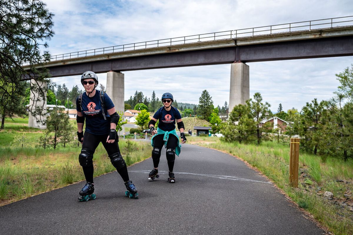
Liz Morley, in front, and Michele Faus set off as they skate the Fish Lake Trail on May 12, 2020. The city is hatching plans to connect the Centennial Trail to the Fish Lake Trail. (COLIN MULVANY)
The city of Spokane may have a path forward for connecting the Fish Lake and Centennial trails.
City officials are poised to move ahead with a route that dodges major obstacles between the two trails and aims to satisfy the concerns of dog lovers and disc throwers alike.
Unlike previous iterations, the new trail design only lightly infringes on the SpokAnimal Dog Park and altogether avoids the nearby disc golf course in High Bridge Park.
“We feel that this is probably the best compromise that we can come up with at this point,” Inga Note, a senior traffic planning engineer, told the City Council’s Urban Experience Committee on Monday.
Officials have struggled to find a route that is economically attainable and logistically feasible without irking park users.
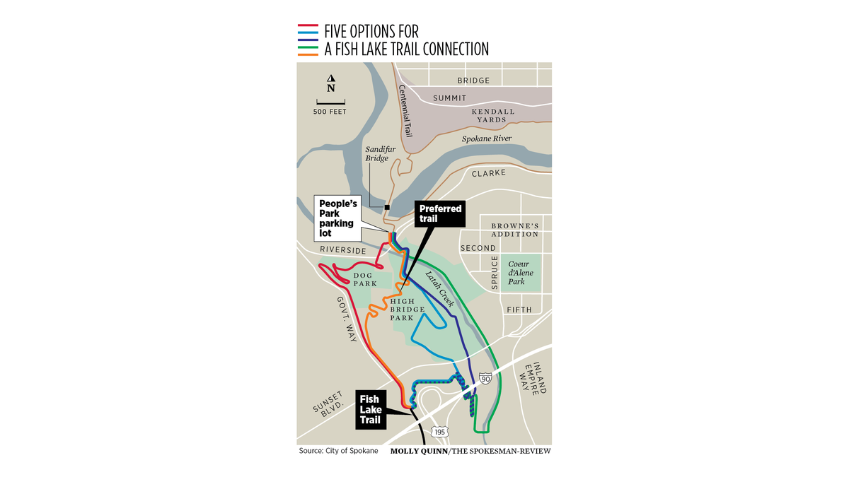
The city’s goal is to connect the Fish Lake at its north terminus on South Lindeke, near the Interstate 90 and U.S. Highway 195 interchange, to both the Centennial Trail and developing South Gorge Trail in Peaceful Valley’s People’s Park.
Drawing the right route has flummoxed city leaders for more than a year.
The city spent $202,000 on a study that produced four potential routes through the land between trails. The city conducted a survey of more than 1,000 people to garner feedback on those options, but none of the routes drew a solid consensus.
Two of the four routes were determined to not be feasible and tossed out of the mix.
The blue route was the favorite of survey respondents, but also the most expensive. It cut through the middle of a popular disc golf course and drew concerns from women about their personal safety in the more remote areas of High Bridge Park.
The red route was the cheapest, but it ran along the busy and bustling Government Way.
Many people said they didn’t want to be riding a bike next to the road noise, or aired concerns over the safety of being so close to motorists.
The path also drew the ire of dog park users, who spotted that it would cut right through the popular trails at the SpokAnimal Dog Park.
Instead of ramming one of those two options through, the city went back to the drawing board and drafted a fifth “orange” route.
Earlier this year, the City Council approved $82,000 to study the orange route in more detail.
After further review, city officials have decided to move forward with the orange route and will apply for federal grant funding to build it.
The cost of construction is estimated at between $10 million and $12.5 million, which is cheaper than the blue route but about $2.5 million more expensive than the red route.
“It’s kind of what we call the compromise route. We took elements from the red and the blue and tried to see if we could find another way down the hill,” Note said.
One small switchback on the trail would cut into the current footprint of the dog park, but the path otherwise avoids the dog park and the disc golf course altogether. It veers into the wooded area east of Government Way, so bicyclists will not have to spend a long stretch next to road noise and vehicles.
The City Council had little negative to say about the route on Monday, but Councilwoman Lori Kinnear urged Note to ensure that the impact to the dog park is minimal.
City officials will present the plan to the Park Board later this week.