Washington and the West are ablaze as 3.5 million acres burn
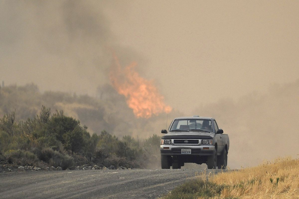
A pickup drives down a dirt road as the Pearl Hill Fire’s flames ignite behind it on Tuesday, Sept. 8, 2020, near Mansfield, Wash. (Tyler Tjomsland / The Spokesman-Review)
While crews have been hard at work protecting structures and slowing the spread of several large wildfires in central and Eastern Washington, containment remained elusive Wednesday.
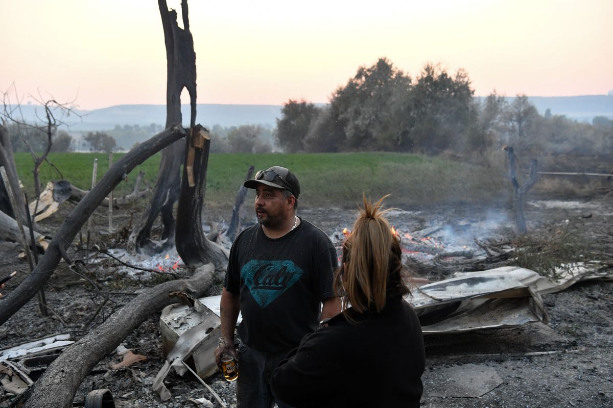
Gov. Jay Inslee is set to tour the devastation in Malden Thursday. Meanwhile, ranchers and firefighters are trying to stop the 130,000-acre fire eating through pasture land west of Spokane near Davenport.
It’s the same situation across the West, where some 96 wildfires are burning across 5,400 square miles.
To put that in perspective, that’s about 3.5 million acres, or five times as much land burned than in the epic Yellowstone National Park fires of 1988.
The flames and smoke have driven thousands of people from their homes in just the states of Washington, Idaho, Oregon and California. Thousands of homes have been razed by the fires, driven especially hard by the Labor Day windstorms.
While the 500,000 acres burned in Washington exceeded entire fire seasons of the past several years, dozens of massive fires in Oregon and California are raging out of control.
There are 35 fires in Oregon alone. Two people are dead, more are missing and Oregonians shocked by the fast-moving flames are descending on Red Cross shelters.
Seven Californians have been killed and 4,300 homes burned. Smoke and fires turned areas, including the city of San Francisco and Yosemite National Park, orange on Wednesday.
While Spokane has averted the smoke from Washington fires so far this week, forecasts predict change is on the way by Friday as winds are expected to shift.
Here’s a rundown on the status of the fires in Washington.
Large fires: Pearl Hill, Cold Springs and Whitney
The Cold Springs Fire that erupted near Omak Sunday night grew Tuesday night and spanned some 163,000 acres by Wednesday with about 10% containment.
Aircraft deployed Tuesday were “highly effective,” according to a news release from the Northeast Washington Interagency Incident Management Team, and more air resources will assist crews numbering about 200 people on the ground today.
The news release notes “multiple structure have been lost,” although it doesn’t say how many or what kind.
Don Malone, public information officer for the Northeast Washington Interagency Incident Management Team, said crews’ focus is on getting a handle on the fire, not evaluating the toll it has taken.
“Honestly, the biggest thing is getting out in front of this thing, then we can start doing those assessments,” Malone said.
Evacuation orders for many people remain in place.
Highway 155 is open but reduced to one lane with a pilot car escorting traffic from Columbia River Road to Hayley Creek Junction.
Malone said the weather was largely cooperating Wednesday with efforts to control the blaze.
“Temperatures are a little bit higher than yesterday, but the winds are pretty calm,” he said.
The nearby Pearl Hill Fire is 174,000 acres, although efforts to contain it have begun to progress, according to the Northeast Washington Interagency Coordination Center.
Located near Bridgeport, the Pearl Hill Fire was 10% contained as of Wednesday morning, although evacuations remain in place, structures continue to be threatened and some roads are still closed.
The Whitney Fire as of late Wednesday spanned more than 130,000 acres in Lincoln County between Davenport and Creston to the north and Harrington and Odessa to the south, according to the Northeast Washington Interagency Incident Management Team. It is 5% contained after crews used bulldozers, aircraft, fire engines and hand crews to dig fire lines and slow the fire’s spread.
Evacuations are still in place as some structures are threatened.
Highway 2, which runs through the northern part of the fire, remains open.
Inchelium Complex
The Inchelium Complex Fire, which combines three fires on the east side of the Colville Reservation, was 20% contained as of Wednesday morning and had burned 8,000 acres. Evacuations remain in place, and officials worried high winds and low humidity could help spread the fire Wednesday.
Crews have containment lines around much of the 2,500-acre Inchelium Highway Fire, which is part of the larger complex of fires. Level 2 evacuations, which urge people to be ready to leave, are in place for residents in the Hall Creek and Seyler Valley Road areas.
Efforts to protect homes at risk from the 500-acre Fry Fire, also part of the complex, were successful Tuesday, but Level 2 evacuations remain in place for people who live near Twin Lakes and Meteor Road. Work on Wednesday will focus on expanding and improving the fire line.
The Kewa Field Fire, the final piece of the complex, was 5,000 acres on Wednesday.
Crews were planning to continue trying to save structures in the area while also expanding the fire line, which was constructed along the blaze’s southern perimeter Tuesday. The Kewa Valley remains under a Level 2 evacuation.
Whitman County fires
The Babb Fire, which burned 8,000 acres as it tore the Whitman County towns of Malden and Pine City on Labor Day, is not contained and 8,000 acres but exhibiting “minimal fire behavior,” the coordination center said Wednesday morning.
The Manning Fire, also in Whitman County, near Colfax, is 2,000 acres and 0% contained. It is showing “moderate fire behavior,” the center said Wednesday morning.
Outages remain for some residents
More than 10,000 electricity customers remained without power Wednesday, two days after a windstorm caused outages to more than 60,000 customers.
Avista Utilities reported about 3,800 customers without power as of 8 a.m. Wednesday. That was down from 33,000 on Monday.
Inland Power reported some 5,000 customers out 8 a.m. Wednesday, down from 14,000 Monday evening.
Kootenai Electric Cooperative reported Wednesday that all power had been restored. About 11,000 customers had been without power Monday afternoon.
Northern Lights Inc., which serves much of Boundary and Bonner counties in North Idaho as well as parts of Western Montana, reported more than 3,100 without power Wednesday morning, down from 11,500 on Monday.

