Washington side of the Columbia Gorge offers plenty of getaway options for outdoor enthusiasts

The next time you drive through the Columbia Gorge National Scenic Area, consider the Washington side for a change.
Sure, the Oregon side deserves all the love it receives. It’s a world of dramatic waterfalls, sheer cliffs and one of the nation’s most beautiful scenic byways.
But don’t count out its lesser-known twin across the river. Washington state Route 14 travels through some equally amazing attractions, from a Stonehenge replica to one of the most thrilling state park hikes you can find anywhere.
And history buffs will find a number of sites along the Washington side of the Columbia that were visited by Lewis and Clark as their expedition neared the Pacific Ocean in 1805.
Last summer’s devastating fires on the Oregon side of the river have temporarily closed many trails, giving you further incentive to explore the north bank of the river.
From east to west, here are some of the highlights.
Maryhill area
As they traveled downstream on the Columbia, Lewis and Clark camped in this area, and you can, too. Maryhill State Park offers riverside camping just off U.S. Highway 97.
Nearby, you’ll find the Stonehenge Memorial, commissioned 100 years ago. It was constructed to honor those who died in World War I from Klickitat County, and offers sweeping views of the Columbia River as it rolls westward.
Maryhill Museum is 3 miles away and offers equally sweeping views from its dramatic grounds overlooking the river. Originally envisioned as a dream home by tycoon Samuel Hill, it became a museum in 1940 and houses several important sculptures by Auguste Rodin, along with many American and European paintings. The grounds are free to explore and the museum charges a reasonable admission.
Just down the road, Maryhill Winery offers some welcome refreshment for weary travelers.
Columbia Hills
About 20 miles farther west, you’ll find one of Washington’s most dramatic state parks.
Columbia Hills Historical State Park is another place Lewis and Clark visited as they neared the now-submerged Celilo Falls, and offers camping, hiking and more than 7,500 feet of shoreline along Horsethief Lake and the river. It also houses some of the best Native American pictographs in the state, including the iconic “She Who Watches,” available to view on ranger-led tours from April to October.
Some of the most scenic trails are accessed off Horsethief Butte, an iconic rock bluff overlooking the gorge, where Clark climbed to get a view. Even better are the trails that wind northward high into the hills of the Dalles Mountain Ranch homesteads. Accessed from the Crawford Oaks Trailhead, the Vista Trail is a riot of wildflowers in springtime, and offers perhaps the best view of the Columbia Gorge, Mount Adams and Mount Hood from the east.
Beacon Rock
Hop back in the car and rumble 56 miles westward through some of the most scenic parts of the Columbia Gorge. When you reach Beacon Rock State Park, consider doing one of the wildest hikes you can imagine.
First, a little background. Beacon Rock is the core of an ancient volcano, washed away by the Missoula floods that helped scour the entire gorge. At 848 feet tall, it looms above the Columbia as a rugged landmark that Lewis and Clark originally called “Beaten Rock.”
It was here that their Corps of Discovery first noticed how the Pacific tides influenced the flow of the Columbia River, and where they first realized they were closing in on their final destination.
Beacon Rock has camping and miles of trails on its 5,100 acres that sprawl high to the north. One popular hike ascends the Hamilton Mountain Saddle for views of Mount Hood and the gorge.
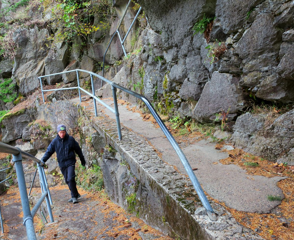
But the quintessential hike is to climb Beacon Rock itself on dizzying milelong switchback trail. Built from 1916 to 1918 by a guy named Henry Biddle, who bought the rock for just $1, it’s an amazing feat of engineering that required blasting and construction of a crazy array of railings and walkways that wind to the top.
“When you think of how they made this trail, I can’t see how it would ever be built today,” said Heath Yates, a ranger at Beacon Rock State Park.
When you hit the top, you’ll have climbed 240 feet higher than the Space Needle in Seattle.
West side of the gorge
Traveling farther west, you’ll hit ever-more lush forests as you close in on the Portland-Vancouver metro area.
About 8 miles west of Beacon Rock, the road rises dramatically above the Columbia River at Cape Horn, site of a rugged 7.7-mile hike that takes in the views, a gorgeous waterfall and the diverse landscape of the scenic area. Washington Trails Association calls the hike “a classic.”
The track is steep and difficult. For a shorter, equally wild experience, consider stopping at Steigerwald Lake National Wildlife Refuge, one of the best places in the gorge to see birdlife. It’s also your final stop within the Columbia Gorge National Scenic Area.
The 2.75-mile-long Art Trail winds through the refuge on an easy, well-marked pathway to the shores of the Columbia River.
Migrating birds are abundant in the wetlands, along with a diverse population of mammals that can be seen from the pleasant path under the gaze of Mount Hood to the southeast.
From here, it’s just a 30-minute drive to Portland or Vancouver as you finish your tour of the Washington side of the gorge.
John Nelson is a freelance writer based in Seattle. Read his blog at ourgrandtour.net.