Changes along Spokane River may be affecting flood conditions

The highest flow on the Spokane River in 20 years is showing evidence that the nature of the river itself may be changing.
A local team from the U.S. Geological Survey used Wednesday’s flood crest in Spokane to measure the river flow and compare it to previous floods.
What they found was a surprise: the river indeed was high, but it was carrying less volume than expected at one location and more volume at another.
The river crested early Wednesday at 28.73 feet at the river gage downstream from Spokane Falls.
That is the fifth highest the river has been at the Spokane gage since measurements began in 1894.
In 1997, the river reached 29.06 feet on the gage with a volume of 42,600 cubic feet per second.
Flood level starts at 27 feet.
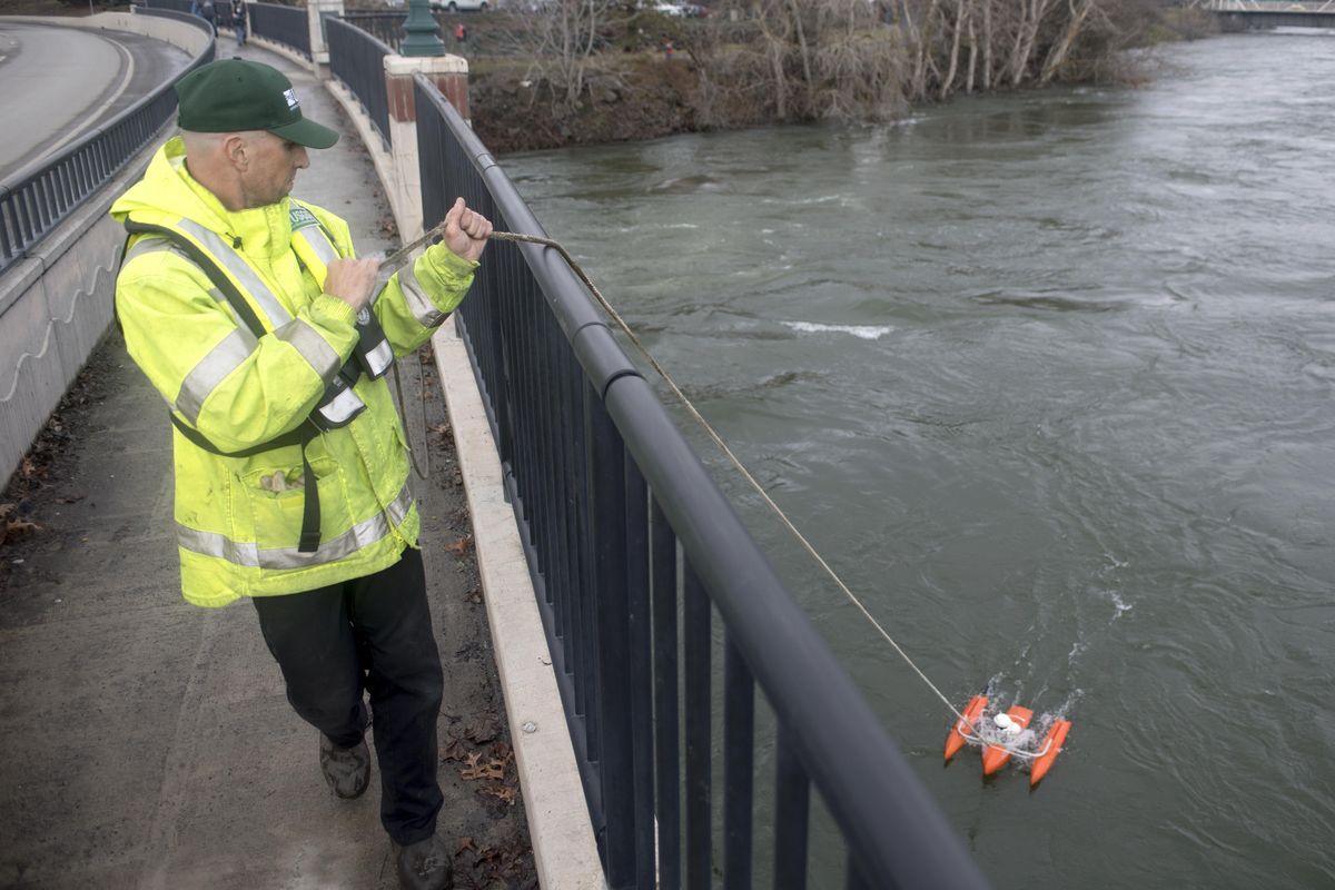
Kevin Wright, supervisory technician for USGS, and two of his crew deployed two high-tech “acoustic Doppler profiler” rafts off the Spokane Falls Boulevard bridge at the University District.
To their surprise, the first measurement showed the volume at 37,100 cfs. A second measurement from a different device confirmed that, but at a slightly lower volume.
Then they went below Nine Mile Dam downstream and measured the flow at 48,300 cfs.
“We are trying to figure it out,” Wright said.
Something appears to have changed in the hydrology of the river, and figuring it out will require more measuring, he said.
Wright said that a number of things can affect volume and height, but changes in river conditions have to be considered.
Scientists know that water flows into and out of the channel in an exchange with the adjacent underground aquifer.
The city of Spokane over the years has been installing huge stormwater retention tanks to reduce river pollution, and that has involved blasting near the river.
Another factor may the growth of vegetation along the banks downstream from Post Falls.
Trunks, limbs, stumps and shoots along the banks can slow river flow, he said.
“In 20 years, trees grow,” Wright said.
A natural riparian zone is good for river habitat. Shade from trees keeps water cooler in the summer, which is healthy for aquatic life, he said.
As a result of the measurements, the USGS may change what they call their “rating table” that establishes the likely volume based on the height of the fixed gage in Peaceful Valley, Wright said.
Erin Rudders, who teaches water resources at Spokane Community College, joined the measuring effort Wednesday and pointed out that scientists don’t have “many data points” to make comparisons between gage height and flow at high water since big floods occur infrequently.
Wright said that other causes for the varying volume could be from ebbs and flows in the flood crest as it moves downstream.
But the river bed itself has been considered to be relatively stable, he said.
At Spokane’s city-owned Upriver Dam, crews Wednesday had five of the eight spillways fully opened and had two others partially opened to prevent flows from backing up.
The dam’s generators were going full speed as well.
The flood has swept up large tree trunks, limbs, planks, old logs and other debris and carried it downstream. A huge mass of debris swirled around either side of the dam spillways on Wednesday. A crew was removing logs and limbs from the forebay boom to protect turbines from debris.
Electricity from the dam is used to power pumps for Spokane’s water system.
An historic open well at the dame showed that the underground water table, or aquifer, was as much as five feet higher than normal, said dam superintendent Stephen Burns.