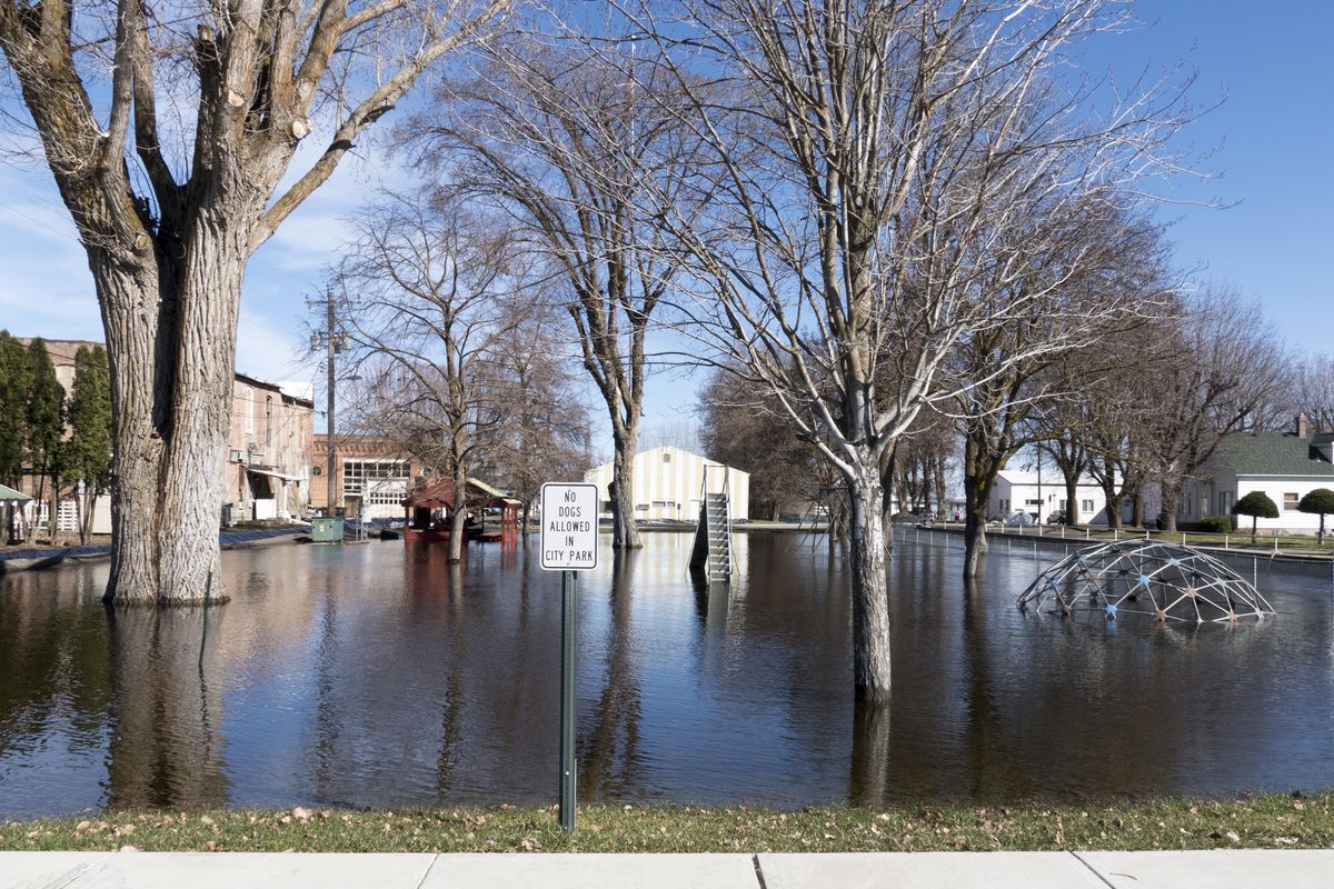
As local waterways swell with spring runoff, residents tread carefully

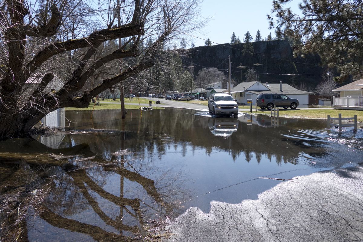


Water flows across Weisman Road from a slough into Williams Lake, Sunday, Mar. 19, 2017, a few inches higher than it was last week. (Jesse Tinsley / The Spokesman-Review)
When Yauve Tharps moved into Brookstone Apartments on East Upriver Drive, the 38-year-old mother didn’t think much about the river rushing by just a stone’s throw away from her front door.
Until this weekend, that is. As she and a group of neighborhood kids spent the sunny late morning Sunday walking her small dog, a dozen feet away lines of cars crept slowly forward, while the more hurried among them plowed through about a foot of Spokane River water spilling out onto both lanes.
“I’ve been here for three years and I’ve never seen it this high,” Tharps said.
“Our apartment is on the beach!” one particularly energetic young girl exclaimed as she took care not to be splashed by the approaching vehicles.
For the first time since 2012, the Spokane River, which hits flood stages at 27 feet and normally runs around 22 feet, has risen above 27.5 feet.
By Sunday morning, the river continued to rise to about 27.76 feet. By Wednesday, it’s expected to crest at about 28.2 feet.
“Long story short: it’s still all that rain and melting snow that’s causing the river to continue to rise,” said National Weather Service forecaster Jeremy Wolf.
Last week, the Inland Northwest experienced several days of rain and higher-than-normal temperatures, which contributed to lakes, streams, creeks and rivers rising to flood levels. By the end of the week the rain had mostly stopped, but the damage was done: all that rain and melting snow filled up water reservoirs, which then flowed out through connecting outlets.
In Lake Coeur d’Alene’s case, that outlet is the Spokane River.
“The Coeur d’Alene Lake is responding to all of the rain and snowmelt,” Wolf said. “That water goes into the Spokane River.”
Elsewhere along the river on Upriver Drive, passers-by stopped their vehicles and marveled at the fast-moving water flowing curiously high. They paused to take photos or throw morsels of food at the hungry ducks and geese floating over what would normally be the Centennial Trail.
In Peaceful Valley, areas of Glover Field and an area east of the Maple Street Bridge were partially submerged, though most people went about their day unaffected. At 28 feet, Wolf said, the flooding of parts of Peaceful Valley becomes much more likely.
“The river will be just shy of how high it got in 2008,” he said.
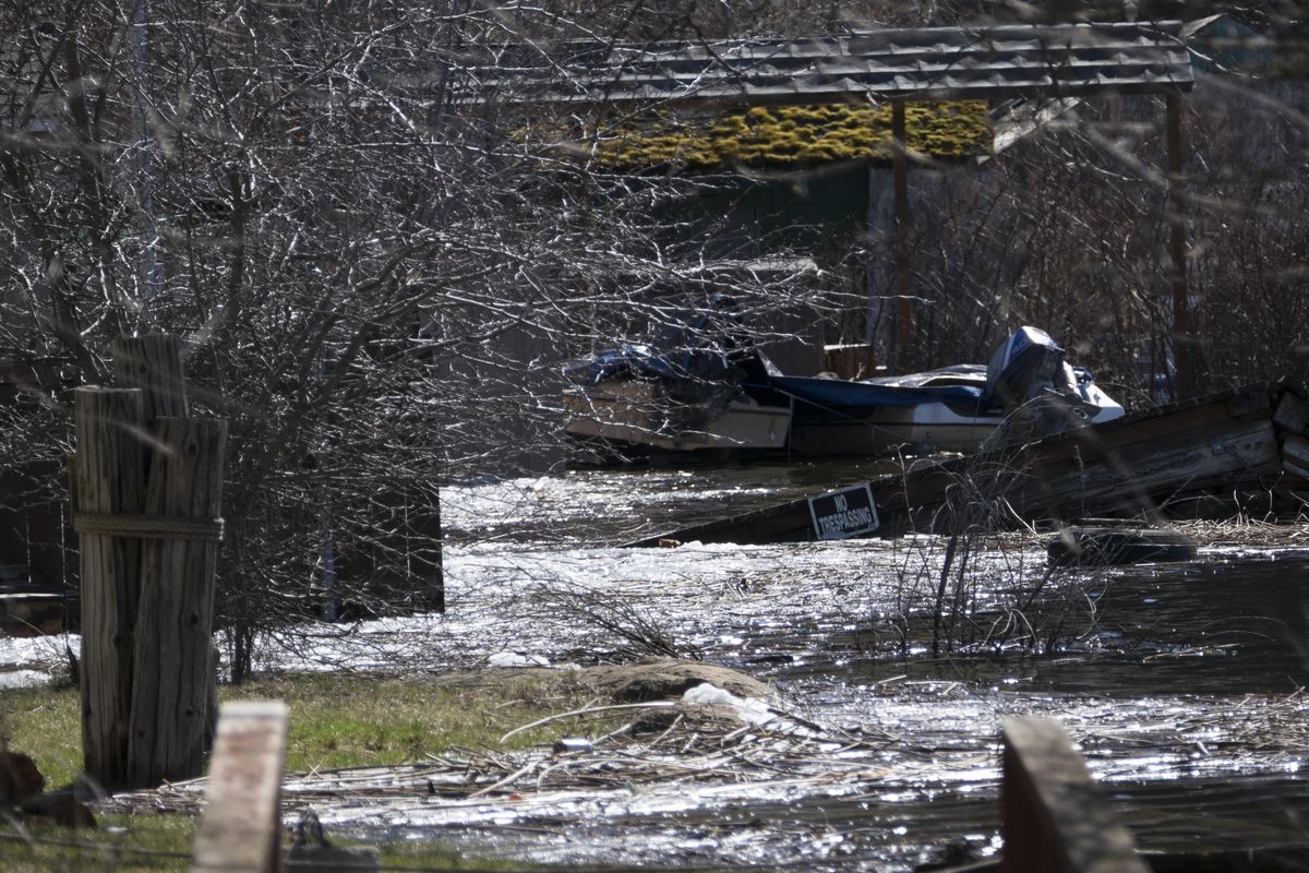
The Kootenai County Sheriff’s Office and Office of Emergency Management issued a news release Sunday warning residents along the Spokane River near U.S. Highway 95 to “monitor rising water levels to prevent potential flooding of homes.” They urged residents in need of sand or sandbags to contact emergency management.
Tharps, who has lived in her apartment near the river for three years, said a neighbor, who has lived there for seven years, remembers the 2012 flooding, when water reached all the way up to the concrete bricks molding the foundation where the large apartment buildings sit.
With about another half-foot of rising water on the way and more rain expected to fall Monday night, Tharps isn’t worried about her apartment flooding, since her building is raised high above the river.
But she does worry about how she and her children will go about their lives if there’s more than a foot of water blocking their car’s route out.
“I don’t know how I’m going to get to work,” she said. “I wonder if they’ll close the road.”
As someone who experienced flooding in New Jersey, she also had a tip for Spokane City Streets Department.
“If it gets this high, do they send out sandbags to stop the flooding?” Tharps asked. “That’s just a suggestion.”