Five objects: Spokane’s history as told through five pieces housed in the Northwest Room

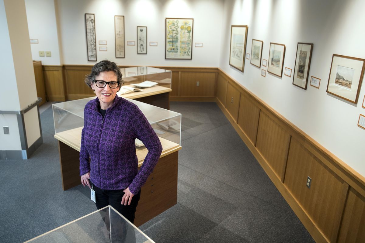


Riva Dean is the Northwest Room librarian at the Spokane Public Library. (Dan Pelle / The Spokesman-Review)Buy a print of this photo
Treasure is buried within the downtown Spokane Public Library.
Although not exactly hidden. This trove is in the Ned M. Barnes Northwest Room, the library’s repository for items too rare and too important to circulate.
It contains thousands of books, photos, documents, and artworks about the Northwest and beyond. You can’t check them out, but anyone with a library card can see them, with assistance from Northwest Room librarian Riva Dean.
To provide just a hint of what the collection contains, Dean helped us choose five items for an article we’ll call, “The Story of Spokane, As Told Through Five Items in the Northwest Room.”
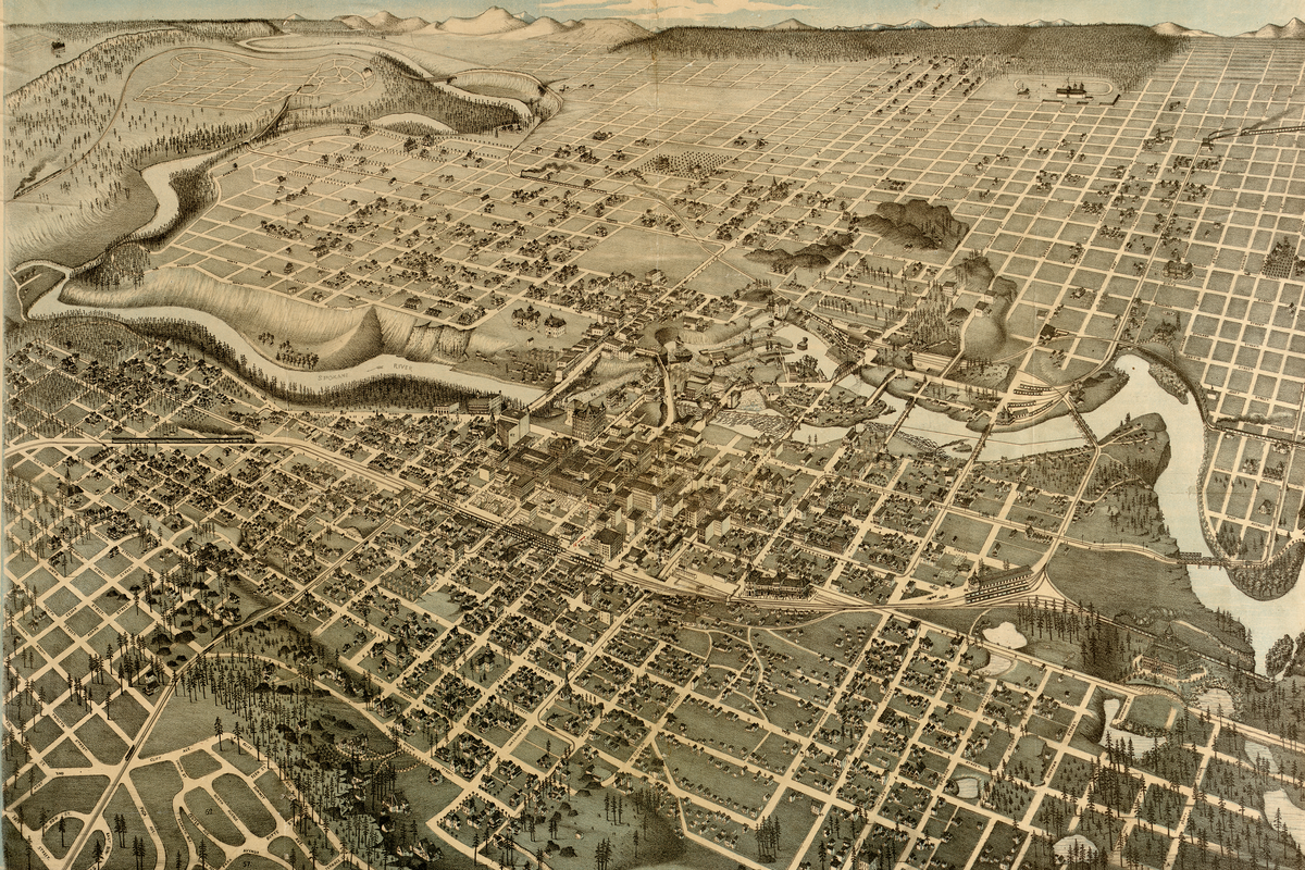
Augustus Koch’s 1890 map, “Panoramic View of Spokane Falls”
Of all the historical maps in the Northwest Room – and there are plenty – the most fascinating may be this beautifully drawn aerial view depicting the city of Spokane Falls “eleven months after the Great Fire.”
Several details are startling to the modern eye. Only scattered houses are depicted north of the Spokane River. A few blocks of commercial buildings line North Monroe Street, but otherwise Spokane north of the river looks mostly rural. At Augusta Avenue and Cedar Street, there’s an orchard.
Development is also sparse on the South Hill past about Seventh Avenue. Spokane’s population was 19,922 in the 1890 census, and nearly all its inhabitants were crammed between the river and the base of the South Hill.
Koch, who traveled the country making these panoramic maps, was commissioned for the job by “H.L. Moody, real estate agent” and the map has a certain boosterish quality. The map’s legend brags, “Population, 28,000; nine banks, nine railways, the best Water Power in the U.S.; 20 miles street railway, and Property very reasonable. Come to the Denver of the Northwest.”
Some of the buildings depicted in the “Denver of the Northwest” are indeed quite impressive. Over in the lower right corner is a grand building topped by towers and flags. It’s the Northwest Industrial Exposition Building, a great source of city pride – and now long gone. Also impressive is the Northern Pacific Passenger Depot – which is now the Spokane Intermodal Center and the city’s Amtrak rail stop.
The Spokane River is lined with mills, smokestacks and power houses, evidence of “the best Water Power in the U.S.” Large commercial buildings jam Sprague, Riverside, Main and Front avenues. The most impressive is the turreted Grand Opera House Block, which housed the spectacular Auditorium Theater, also long gone. Another grand building, at Front Street (now Spokane Falls Boulevard) and Washington Street was the multi-story New York Brewery. The city’s breweries rivaled the city’s churches in size and splendor.
The map gives plenty of insight into Spokane transportation, circa 1890. A multi-track railroad line cuts straight through the heart of the city. A passenger train is depicted steaming in from the west. Several streetcar lines branch out from downtown. Over the next few years, these streetcar routes would dictate where Spokane’s residential growth was destined to occur.
You could stand in front of this map for hours and learn new things about the early city. And, by the way, you can literally stand in front of this map for hours. It is on display on the wall near the back of the Northwest Room. This is only one of several big wall maps on display. Another giant one, from 1893, shows every land parcel in Spokane County – complete with the names of the owners.
Isaac A. Stevens’ 1853 survey of the Spokane country
The Northwest Room consists mostly of shelves full of books, and the most valuable ones are kept in a vault behind the librarian’s desk (and are also available for study). One rare set of volumes is particularly fascinating for its early descriptions of Spokane and vicinity.
Its title is a mouthful: “Reports of Explorations and Surveys, to Ascertain the most Practicable Economical Route for a Railroad From the Mississippi River to the Pacific Ocean, Made Under the Secretary of War, in 1853-60.” It includes the report made by Isaac A. Stevens, the first governor of Washington Territory, describing his expedition through the region in 1853.
Here’s an excerpt from Volume 12, Part One, containing Stevens’ account of trekking from what he called the Coeur d’Alene Mission (today’s Cataldo Mission) to what is now Spokane:
“Soon after leaving camp, the Coeur d’Alene lake came into view to the south of us … . It is a beautiful sheet of water, surrounded by picturesque hills mostly covered with wood. Its shape is irregular, unlike that given upon the maps … . Leaving the lake, we followed the river on its northern bank, passing a camp of Coeur d’Alenes, occupied with their trout fisheries. Here we witnessed a touching sight, a daughter administering to her dying father.”
Stevens, maddeningly, provides no further details of this poignant scene. Stevens does, however go on to describe the “falls of the Coeur d’Alene river” – by which he means the Spokane Falls in what is now downtown Spokane.
“Here there is a small Indian village, and inhabitants were engaged in catching salmon,” wrote Stevens. “I noticed one large woman, who seemed to pride herself upon her person, which she took pains to set off in the most becoming manner, by means of a blanket wrapped around her.”
Stevens, as territorial governor, would become a controversial and much-criticized figure for his treatment of the region’s Indian tribes. In this report, however, he offers an approving character sketch of Chief Garry, one of the Spokane tribal leaders, after he encountered Garry and 200 other Spokane Indians on the banks of the Spokane River
“I have now seen a great deal of Garry and am much pleased with him,” wrote Stevens. “Beneath a quiet exterior, he shows himself to be a man of judgment, forecast and great reliability, and I could see in my interview with his band the ascendancy he possesses over them.”
The 1786 painting, “View in Nootka Sound,” by John Webber
What story does an oil painting, depicting Nootka Sound on Vancouver Island, tell about Spokane?
On the surface, nothing explicit. It depicts a group of coastal Indians, on the beach below a misty, moody outcrop. Another party of Indians is rowing a canoe onto the beach.
However, it does document a significant time not just for Nootka Sound, but for the entire Northwest. John Webber was the official artist for Captain James Cook’s third voyage of discovery. Cook’s voyage was one of the earliest encounters between Europeans and Northwest Native Americans. Even though the encounter on Nootka Sound took place hundreds of miles from Spokane, it was among the events that set in motion a century of upheaval that would eventually transform the lives of Indians not just in Nootka Sound, but in the Inland Northwest as well.
This painting also made us ponder another story: How did a 1786 oil painting, painted by Capt. Cook’s artist, end up in the Northwest Room?
It’s the story of a Spokane librarian who believed in preserving history of all kinds. This painting is part of the Fuller Collection, which forms the core of the Northwest Room. George W. Fuller was Spokane’s first librarian and he believed that a library should also be a de facto cultural museum, especially since Spokane had no other museum at the time.
He collected an impressive trove of rare books – a leaf from the Gutenberg Bible, for instance, and a 1483 Venetian Bible – reflecting his fascination with the history of printing. He also collected books, documents, objects and artifacts of Northwest history – and even the occasional Northwest-themed oil painting.
Nobody is certain how Fuller came to acquire this beautiful oil painting on copper. Webber painted it in London, based on sketches he made while anchored with Capt. Cook in Nootka Sound. We can only speculate about its journey from London to Spokane. Fuller surely would have documented its provenance, yet the documentation apparently disappeared in one of the library’s many moves.
However, we know that it is the oldest and rarest painting in the Northwest Room. In 1976, the Spokane Public Library had it restored and re-framed by the Portland Art Museum. At the time, it was valued at $4,000.
“On Spokane River,” 1910 photograph by Edward Curtis
This sepia-toned print depicts a group of Spokane Indians on horseback, high above the Spokane River – a beautiful moment, captured by famed Seattle photographer Edward Curtis.
The story it tells appears obvious. A group of indigenous people are gathered together on the river they have called home for millennia. They are comfortable in their own element.
Curtis, in his own caption, noted that the river “flows through the midst of what was the territory of the Spokan Indians” and that “northward from the stream lie the mountains among which the three Spokan tribes hunted deer and gathered their supplies of roots.”
Note the past tense. This photo was printed in 1910, decades after what “was” the territory of the Spokanes had been transformed by the arrival of white settlers and white civilization. In 1910, the population of Spokane had exploded to 104,402.
In a letter at the time, Curtis said he made a camp overlooking the lower Spokane River and “word was sent to our old friends to visit and feast with us, and within 48 hours we had the best members of the tribe in our camp.” These are, presumably, some of the people in this photo. The setting and the moment appear idyllic, yet keep in mind that Curtis was not above posing his subjects for romantic effect.
The Spokane Reservation, where this photo was taken, was established in 1881, along the north bank of lower portions of the river. Not all the Spokane Indians, by any means, moved there. Chief Garry refused and spent most of his life arguing for a reservation that would include land on both sides of river, starting at the city of Spokane and downstream to Tum Tum. He argued in vain.
This photo is part of Curtis’s 20-volume masterpiece, “The North American Indian,” and the Northwest Room has the complete set. Credit goes once again to George W. Fuller, who paid $3,200 in 1913 to become one of the original subscribers. He believed the work was important to the history of West, and he also believed it would be a good investment. He was correct on both counts.
This is now by far the most valuable item in the Northwest Room, worth probably more than $1 million – not that the library has any plans to ever sell it. The fact is, everyone who has a Spokane Public Library card already owns this astonishing work. You can peruse it – very carefully – by appointment in the Northwest Room.
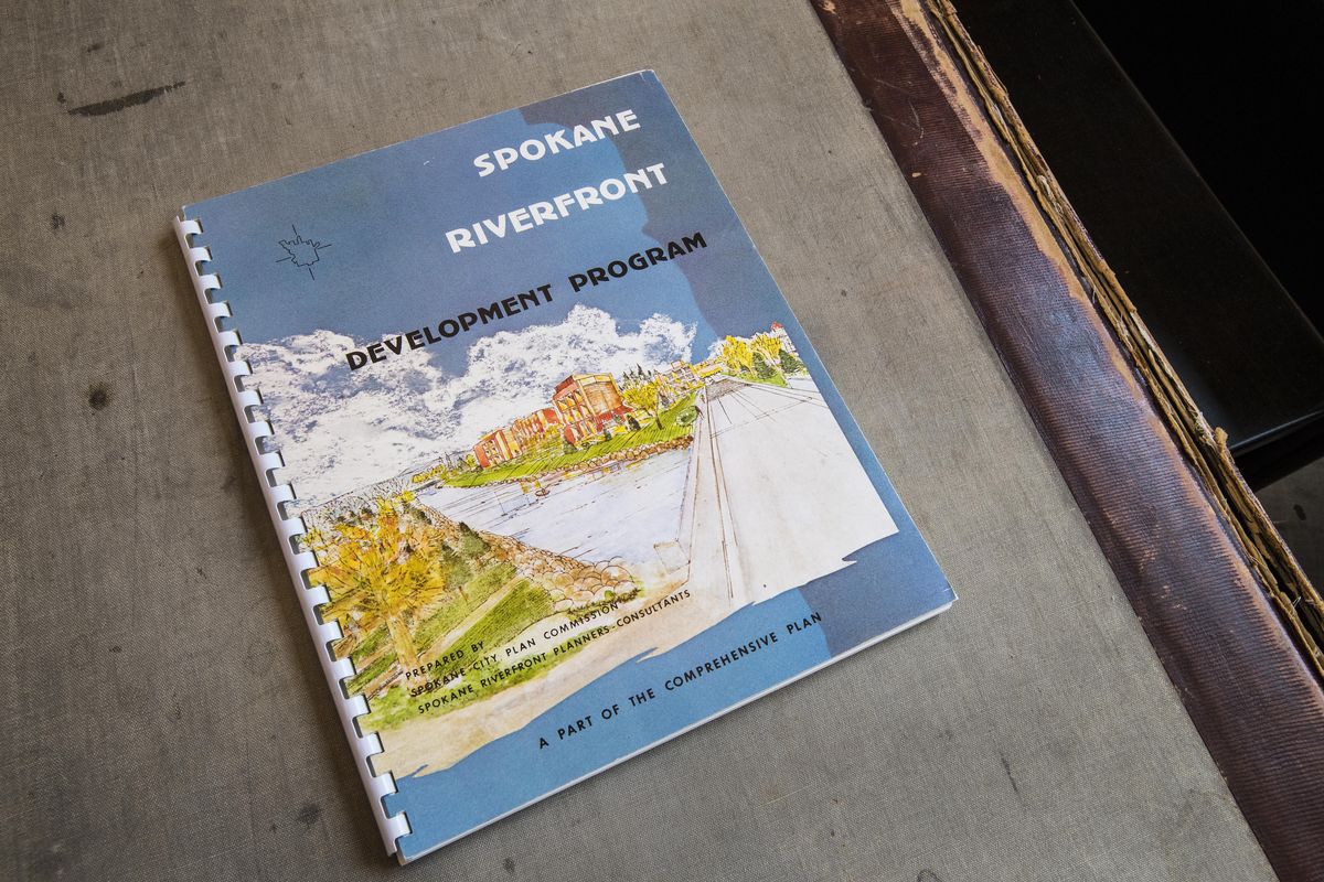
Spokane Riverfront Development Program, City of Spokane, 1974
The Ephemera Collection in the Northwest Room sounds, frankly, a bit dull. Ephemera, in the archival sense, refers to items not necessarily intended to be of lasting value. Yet, in many cases, these items hold significance deep beneath the surface.
“The Spokane Riverfront Development Program,” buried in Box No. 2 of the Ephemera Collection, is a perfect example. It’s a city government planning document, and it looks as boring as it sounds. It’s 116 bound pages of design plans, policies and “action programs.”
Yet in its pages can be found the most profound revolution in the city’s last 100 years. This report details the plans and processes by which Spokane would, essentially, transform itself from ugly duckling to swan. Page 8 of the report explicitly states its goal: “To reclaim the people’s river resource.”
The booklet explains all of the complex steps needed to turn downtown’s riverfront from an industrial wasteland, walled off from the people by a giant barricade of railroad viaducts, into today’s Riverfront Park.
This report was issued just before the opening of Expo ’74, which would serve as the catalyst for Spokane’s biggest-ever urban renewal project. Yet the planning had already been going on for decades. Some of the content headings give a hint of the complications: Existing Land Use, Proposed Land Use, Industrial (Use), Commercial (Use), Flooding, The Riverfront Ecology, and Analysis of Environmental Impact.
Finally, the report summarized the “Status of the Plan,” on the eve of Expo ’74. It said that Expo had “accelerated the achievement of the central part of the plan by many years,” and that “Spokane is off to a fast start.” In fact, the work had proceeded “beyond the dreams” of its initiators.
Yet the report warned that this was to be “a long-distance effort” and that, “public motivation, now enthusiastic, must be sustained for the long haul.”
A glance at Riverfront Park in 2017, with shovels and cranes back in motion, proves that “reclaiming the people’s river resource” remains a work in progress.
Jim Kershner is a staff historian for HistoryLink, the Online Encyclopedia of Washington State History, and a senior correspondent for The Spokesman-Review. He is also the chairman of the Board of Trustees of the Spokane Public Library.