Mid-winter snowpack is near normal for the region, surveys indicate
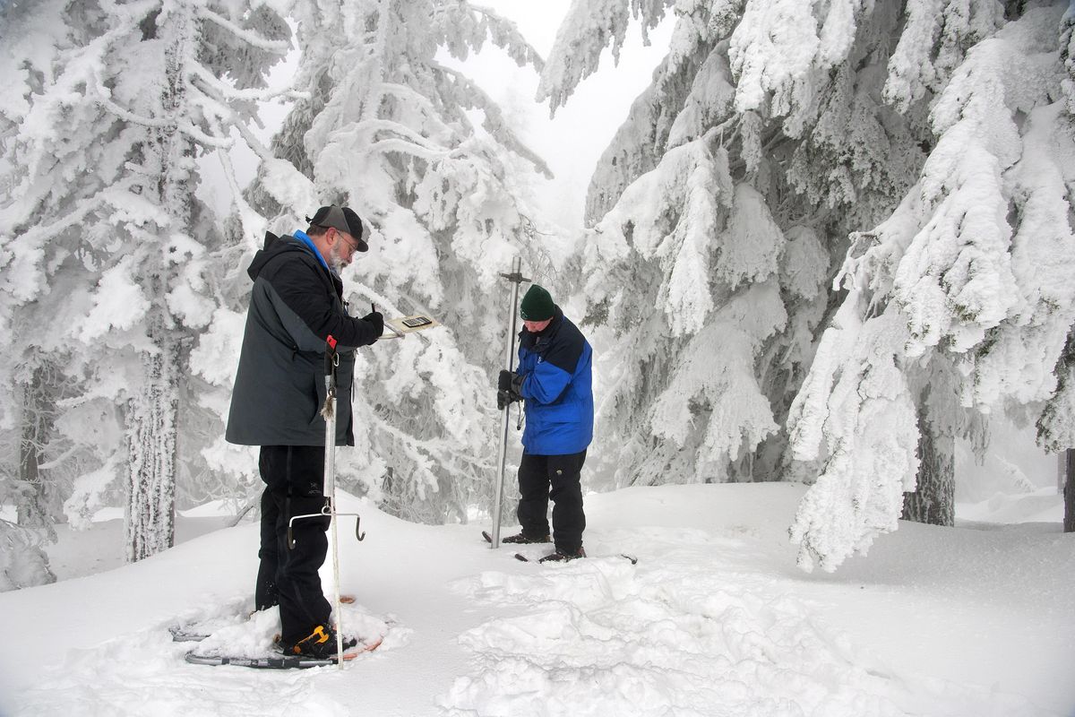
Dave Kreft spent the last week of January on snowmobiles and snowshoes, visiting remote mountain sites in northeast Washington to measure snow depth and water content.
The surveys revealed a midwinter snowpack that’s near normal.
“It’s shaping up to be an average year, and average is good, particularly compared to last year,” said Kreft, a snow surveyor for the Natural Resources Conservation Service in Spokane.
Last year’s “snow drought” led to havoc around the region, setting the stage for an incendiary wildfire season, water shortages and poor survival rates for migrating sockeye salmon.
But if mountain snows continue to accumulate through April 1, the region should experience a return to normal water conditions this summer, Kreft said.
On Thursday morning, he and colleague Wes Durheim took test measurements of the snowpack near the Nordic Center at Mount Spokane State Park. The snow was 49 inches deep near the lodge. Cross country skiers raced down nearby trails dusted with fresh snow from Wednesday night’s storm.
At Quartz Peak, where the agency’s official Mount Spokane snow surveys are done, the snowpack was about 134 percent of average.
“We’re not suffering from the leftovers of the drought,” Ron Miller, a meteorologist with the National Weather Service in Spokane, said in a phone interview.
Most of the Inland Northwest is experiencing normal winter conditions, with the exception of the central part of the Idaho Panhandle, he said. Snowpacks are about 80 percent of normal at Lookout Pass on the Idaho-Montana border, and they’re also below normal for other parts of Shoshone County.
Two more months of winter remain, which could shift the totals either way.
“We still want to see what February and March bring us,” Kreft said.
Western snowpack is sometimes referred to as “money in the bank.” It’s the currency that determines how much water will be available in the summer to irrigate crops, generate hydroelectric power, provide stream flows for fish and water for boating and other recreation.
Snowpack is also a predictor of the severity of fire season. When the snow melts early and the forest dries out, lightning strikes are more likely to trigger wildfires.
For forecasting purposes, the depth of the snowpack doesn’t matter as much as its moisture content, Miller said. Periodic rainfall helps the snowpack by increasing the water content.
Under the right conditions, “the snow is going to absorb a lot of that rain,” Miller said. “The ice crystals will hold onto it.”
To measure the snowpack, Kreft and his co-workers use methodology developed more than a century ago during Nevada’s water wars. With farmers and ranchers fighting over water allocations, a University of Nevada professor created a prototype for predicting runoff and future water supply. James Church used stove pipe to measure snow depth in the Sierra Nevadas and weighed the snow to calculate its water content.
Aluminum tubes have replaced the stove pipe, but otherwise, “the technology hasn’t changed,” Kreft said.
He and his team track the snowpack at 16 sites in the Spokane, Upper Columbia and Pend Oreille river basins. Four of the sites have automated equipment for measuring snow depth and water content, but the surveyors visit the other locations in January, February and March to take manual measurements.
Getting to one snow survey site in southwestern Pend Oreille County requires a 10-mile snowmobile ride, followed by a snowshoe hike. Most of the sites have been monitored since the 1940s, providing valuable information about changes in the region’s snowpack over time.
“Those were real men,” Kreft said of the individuals who trekked up mountains in an earlier era to conduct snow surveys. “We have Gore-Tex and snowmobiles. They had wool, leather and wooden snowshoes.”