Probe digs up mysteries about landslide’s cause
Clues may reveal how to rebuild Highway 410

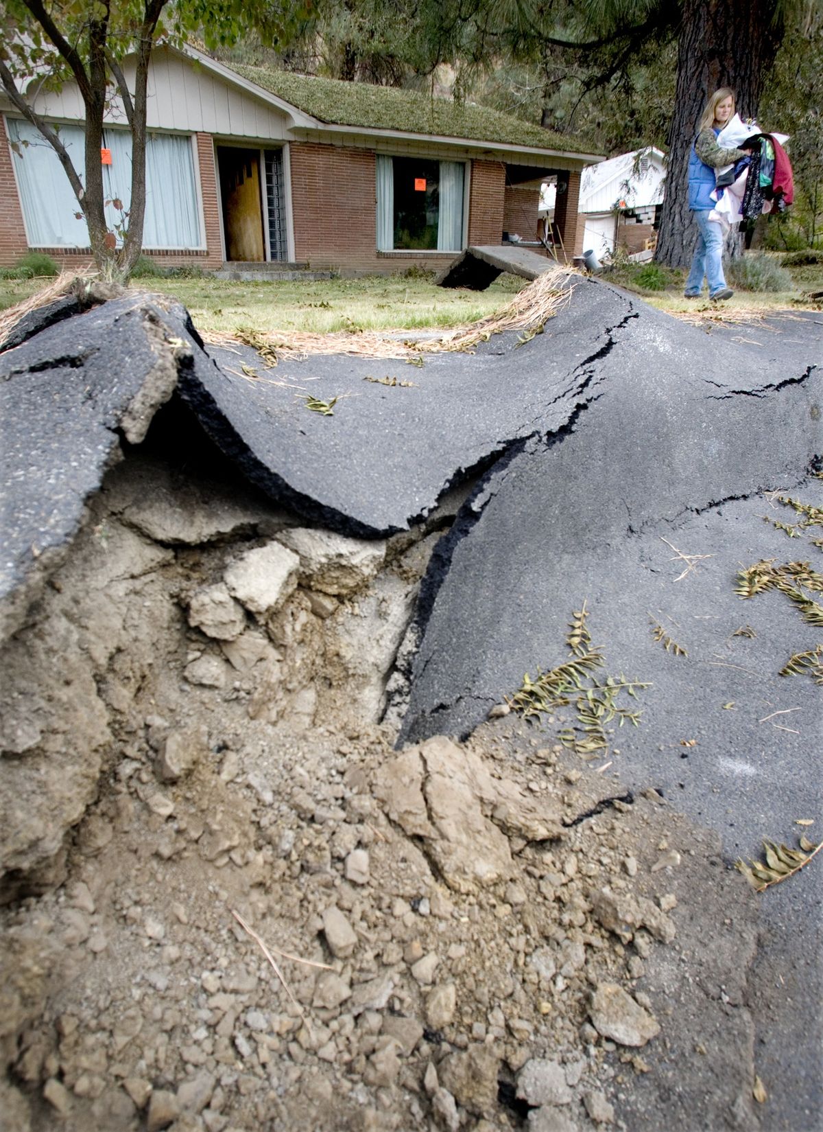
SEATTLE – Geologists working to unravel one of the most destructive landslides in state history still haven’t found a smoking gun – but they’re beginning to dig up some pretty hot clues.
Chief among them is that the seemingly solid Yakima County hillside that collapsed onto state Highway 410 near Naches was underlain by layers of rock as soft as putty and packed with so much water that crews unleashed geysers when they drilled into the debris.
Those soft, saturated layers, 200 to 250 feet below the surface, are the main suspects behind the spectacular collapse the morning of Oct. 11. But there’s still a mountain of data to sort through to reconstruct what happened – and figure out where to rebuild the highway, said Steve Lowell, chief of the Washington State Department of Transportation’s Geotechnical Division.
The question of whether the slide was triggered by gravel mining at the base of the slope is being tackled by Washington’s Department of Natural Resources, which regulates mine reclamation. Drawing from the same mountain of data, DNR geologists plan to re-create the mine’s operations with a computer model, to determine if the excavation could have undermined the slope.
The arid cliffs along Highway 410 northwest of Yakima were sculpted by giant landslides 1 million or more years ago. But no one was prepared for the scene that unfolded on that clear Sunday last fall.
Forty million cubic yards of rock and dirt – enough to fill Safeco Field more than 10 times – came roaring down over the course of several hours. The slide buried nearly one-half mile of highway and shoved the Naches River out of its banks.
No one was hurt, but several homes were destroyed or damaged beyond repair.
The disaster’s price tag includes more than $13 million to reroute the river channel and build a detour road across former pastureland.
But the new roadway isn’t designed to handle the traffic that streams between the west and east sides of the state once snowy Chinook Pass opens in the spring, said Brian White, WSDOT assistant regional administrator for development. Nor do local residents want all those cars whizzing past their homes.
So WSDOT intends to rebuild the stretch of Highway 410. The question: Where?
The answer depends on the results of the landslide investigation.
If the landslide is stable or could be shored up with barriers, crews may be able to build around or over it, at an estimated cost of $15 million to $25 million. But if it’s likely to keep sliding, WSDOT may have to move the road to the other side of the Naches River – an option that could cost up to $50 million.
To help build a three-dimensional picture, scientists at Washington State University identified each basalt layer through chemical analysis. Workers at WSDOT’s lab are analyzing the strength of each layer of earth.
That information will be fed into a computer model that allows geologists to essentially rewind time: to simulate conditions before the landslide, then see what could have caused the slope to come crashing down.
“If it lurches again and blocks the Naches River (again), that’s going to be pretty bad for everyone,” DNR geologist Isabelle Sarikhan said.
Aerial photos show the landslide started slipping as early as 1998. DNR inspectors noticed large cracks above the Simmons & Son quarry, and warned the operators in 2005 that they might be destabilizing the slope.
After the slide, which swallowed up the quarry’s rock crusher but stopped just short of a house on the site, DNR ordered a halt to all mining until the owners conduct a stability analysis, which would include core drilling.
The mine owners appealed.