Shifting Sands Hikers revel in dunes’ natural variety

TIME FLIES IN THE Oregon Dunes National Recreation Area. Like the wind, in fact. With no rocky headlands between Florence and North Bend to block sun-dried beach sand from blowing inland, one of the world’s most fascinating ecosystems took shape and yet remains ever changing. Now you see it, now you don’t.
Dunes form to nearly 500 feet, then all but vanish. An entire forest may emerge within 50 years — blinding speed in geologic time — and then vanish beneath the shifting sands.
Fourteen hiking trails meander through the sand dunes, which harbor wetlands, lakes, creeks, forests and fascinating wildlife. But good luck exploring all the trails, because no single hike ever seems to be quite the same.
Ned Russell of Reedsport hikes one trail in the Oregon Dunes National Recreation Area every Tuesday of the year — even more often some weeks — with his dog Buddy. On one morning, with the sun breaking through light rain showers, the pair are set to hike along the Tahkenitch Creek Loop Trail about 10 miles south of Florence.
“The creek changes form so much,” says Russell, 55, a longtime grocery store manager before taking a “post-retirement” job as a merchandiser for Williams Bread. “It’s just like the dunes. When you come back, they’re different, continually shifting.”
The Tahkenitch Creek hike is one of the best for seeing the dynamic dunes in action. Hikers can take one of several loops, but following the trail about two miles to the beach means passing through wetlands, open areas of sand and a long, narrow forest.
The forest boasts a thriving understory of salal, evergreen huckleberry, kinnikinnick and scotch broom. But it’s the trees and their tangled branches, many encrusted with pale green lichens, that steal the show.
A shore pine has multiple trunks that stretch out like groping octopus arms. Sitka spruce trees are suspended in animation, their backs forever bent from the “Krumholtz effect” — relentless exposure to the ocean’s wind and salt spray.
Wildlife abounds. Once, Russell saw a black bear in a dunes meadow. He’s been startled by a covey of quail, watched sea lions wallow at the mouth of Tahkenitch Creek, and seen more squirrels, rabbits, ducks, geese, frogs and lizards than he can count.
Three years ago, around Thanksgiving, he thinks he could have walked across the spawning salmon at Tahkenitch Creek.
“It’s one of the most beautiful sites I’ve ever seen,” Russell says.
The same, hard-winding creek holds other surprises if you’re patient.
“Look for a ripple in the water,” Russell explains. “You won’t see the otter right away, but if you keep paying attention to the ripples, pretty soon you’ll see a head pop up, looking around. Then you’ll see the whole body. And you never see just one otter — I’ve seen as many as six together, catching and eating fish.”
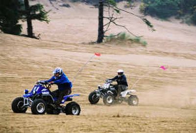
The Oregon Dunes National Recreation Area stretches for 53 miles along the central Oregon coastline. About 3 miles wide, it contains 30 lakes for fishing, swimming and wildlife watching; 14 hiking trails; 13 campgrounds; 11 beach parking areas; nine day-use areas; and three off-highway riding areas.
Your first visit to the dunes should begin with a stop at the ODNRA’s visitor information office in Reedsport. From May through September, the office is open from 8 a.m. to 4:30 p.m. seven days a week.
Ask to watch the video “Dunes!” in the visitor center’s theater room. The video offers insight into the geography of the dunes, plus touches on environmental issues, such as protecting habitat of the Western snowy plover and how vast expanses of dunes are being overtaken by the proliferation of European beach grass planted in the 1920s.
A great second stop is the Oregon Dunes Overlook, nearly 10 miles south of Florence. The overlook includes big viewing platforms, interpretive areas and a hiking trail.