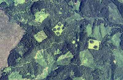
Aerial view of state’s history

OLYMPIA – Tucked away in an air-conditioned archive in Olympia, behind black doors and concrete walls, is a collection that one state official calls “the time machine.” It consists of thousands of metal and plastic canisters, each containing 200 feet or more of high-resolution film. Since the late 1950s, state-hired aircraft have been flying swaths across Washington’s skies, using million-dollar cameras to document the state’s changing landscape. This summer, one of those planes has been flying over Spokane and the rest of northeastern Washington, adding thousands more feet of film to the collection. Comparing photos over the years, you can see irrigation bringing to life the arid soils of central Washington. Dark-green forest canopies are erased by the chain saw and replaced by the light green of brush and saplings, which slowly fill the canopy back in. Rivers erode banks and deposit sand bars. And houses, factories, offices and stores grow outward from cities, erasing farmland, like ripples from a dropped stone. The archive is the work of the state Department of Natural Resources, which oversees millions of acres of state property, including forests, wheat fields, tide flats and shellfish beds. The agency regulates forestry – including on private land – makes maps, puts out fires and runs a network of tsunami early-warning stations along the coast. Many of the photographs are used to make maps. But the photographs can also help state officials figure out if someone’s logging too close to a stream or selling timber without paying the taxes on it. Aerial photos have helped pinpoint the cause of forest fires, helped find landslide-prone areas and been used to research unusual bits of wildlife habitat. Landowners sometimes use the archive to solve old boundary disputes. Retailers study residential growth and traffic patterns over the years when they decide where to site a new store. “We can recreate the past accurately,” said Tim Gregg, geographic services manager for the department. “Photographs don’t lie.” The state used the system to map the location of every piling in Tacoma’s Commencement Bay. The pilings are treated with creosote and other chemicals. “You can’t drive out there and see every square inch, but we can,” said Terry Curtis, a DNR photo expert. “Most people don’t know that Big Brother is up there.” The archive is believed to be the largest state collection of aerial photos in America, and the department spends about $1 million a year on the program. The state used to photograph each section of the state every two years; now it’s every four. The last time northeastern Washington was photographed was in 2000. “Our legacy is this aerial film vault,” Gregg said. “It’s going to support public decision-making long after I’m dead.” The photos are typically made from either 12,000 feet or 22,000 feet up. The flight paths overlap, and by looking at two prints through a stereoscopic viewer, you can see the images in 3-D. It’s like a giant version of a child’s 3-D View-Master. The resulting photos aren’t the stuff of spy movies – even at extreme magnification, it’s impossible to make out fine details. You can tell a car from a pickup, but can’t tell what kind of car it is. You can see that a particular speck is probably a dog, but not what kind of dog. There have been some complications and quirks over the years. Photo technicians discovered that if something moves before the plane sweeps back for the next photo, they get a false elevation reading on that object. A herd of grazing cattle shot years ago, for example, are known as the “Flying Cows of McNeil Island,” because viewed in 3-D, it looks as if they’re all at different altitudes. The photo flights raised security concerns about 35 years ago, when federal agents showed up at the aerial photo contractor’s lab and used razors to slice out images of certain areas of the Hanford Nuclear Reservation. “They just cut out a big chunk of it,” Gregg said. Nothing similar has happened in decades, he said.