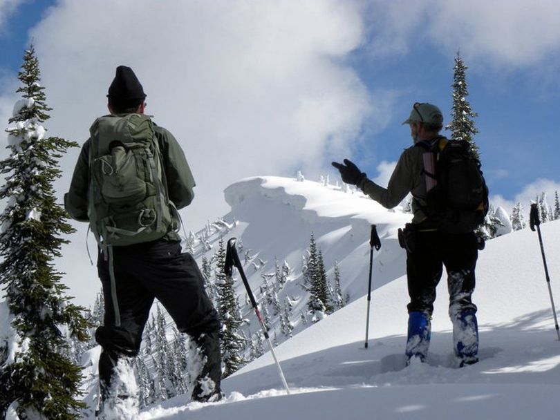
Season hasn’t ended for Panhandle avalanche forecasters

WINTER-LIKE SPRING TRAVEL -- Kevin Davis of the Idaho Panhandle National Forest Avalanche Center woke to an inch of new snow at Sandpoint. He kicked into gear this morning to revise his "spring" avalanche advisory even though his reporting season ended two weeks ago.
"We thought winter was over but it’s kind of not," he said.
In the high country, snow depths continue to increase rather than degrease, with more than 16 feet of snow recorded at some Snotel sites.
The Panhandle is 153 percent of average for snowpack, the Spokane drainage area is 147 percent and the Clearwater region is at about 142 pecent of an average snowpack this year.
Read on for Davis's observations for anyone venturing into the region's avalanche terrain this spring.
SPRING TRAVEL TIPS
Spring is generally a safe time to travel in the mountains but there are some rules to live by. The safest and best conditions will exist after a good nighttime freeze. Dig a pit to see how deeply the freeze penetrated. This will give you an idea of how quickly the snow will become slushy and unstable. Get on the slopes early before the temperatures get too warm or the sun gets too intense.
Mountain temperatures above 50 degrees should be an indicator that conditions are becoming unstable. Strong radiation can penetrate deep into the pack and destabilize weak layers. Steep south facing slopes are affected most rapidly by strong sun. If you are into the slush up to your boots or you’re laying on the throttle to move its time to get off the slope. By planning your route to take you to slopes just as they come into the sun and begin to thaw you can enjoy good, safe sliding. Always be careful around rock outcroppings because they hold heat and weaken the snow for some distance around them.
Rain always weakens the snow pack and this time of year rain can lubricate ice crusts making the overlying layers more prone to slide. When we do get new snow watch for the type of surface it is bonding to. New snow on an ice crust that is experiencing melting during the day can be extremely unstable, especially if it is wind-loaded. In general, new snow will be more sensitive to radiation. Surface hoar can also be a weak layer in the spring so check under the new snow accumulation to make sure you’re not dealing with that little devil.
Finally, keep track of extended periods of thawing, not only during the day but most importantly overnight. This will also decrease snow stability. Night-time temperatures below freezing are a must for good sliding conditions, and safe sliding conditions. The more nights in a row that freezing conditions occur, the more stable the snow is likely to be. Freezing conditions will usually accompany clear nights while overcast nights tend to trap heat.
In the high country the Panhandle is 153% of average for snowpack, the Spokane drainage area is 147% and the Clearwater region is at about 142% of an average snowpack this year. Lost Lake snotel has surpassed the 200 inch mark on depth; that’s over 16 feet of snow! All mountains above 4,000 feet continue to accumulate snow.
I saw some sleds heading out this morning. Unfortunately, I have not been out in a couple of weeks, but I have been keeping my eye on the weather. Temperatures have been cold with only brief periods of warming and settlement of the pack. I would approach your travels in the mountains as if it were January. New snow could be unstable, north aspects will potentially have weaker layers due to colder temperatures, and pockets of wind-loading will be more unstable due to loading. This will change quickly when the temperatures rise, the new snow in the upper 1-3 feet will become unstable, and this could trigger deeper slabs in places.
The Climate Prediction Center is showing below average temperatures and above average precipitation for the month of May. The wind has built up some very large cornices and these will become unstable as the weather warms. Be cautious near ridgelines where wind deposition could be deep on multiple aspects. Winter weather will continue into next week so be thinking about potential slab avalanche conditions with new snow and for a 24 hour period after the storm. Check to see if the new snow is loading up over a layer of surface hoar.
On your ventures into the high country remember to respect old terra firma, the brown stuff, that sticks to your boots and tracks on the way up. Don’t rut up the roads and trails in your truck or ATV trying to get an extra 100 feet. Park before you get to the muddy sections and try to avoid them as much as possible. Just like your tracks in the snow, leave no trace. Have a great spring. We’ll be back next year with the first winter snows.
Avalanche conditions change for better or worse continually. Backcountry travelers should be prepared to assess current conditions for themselves, plan their routes of travel accordingly, and never travel alone. Backcountry travelers can reduce their exposure to avalanche hazards by utilizing timbered trails and ridge routes and by avoiding open and exposed terrain with slope angles of 30 degrees or more. Backcountry travelers should carry the necessary avalanche rescue equipment such as a shovel, avalanche probe or probe ski poles, a rescue beacon and a well-equipped first aid kit.
