Gardening: Spring may be early, but be wary of frost
Dare I say we are having an early spring this year?
The grass in my backyard has greened up and I saw forsythia bushes blooming in the south Spokane Valley last weekend. The grass in my shady, cold backyard doesn’t normally green up until the second week of April in a normal year.
Given that, spring may be as much as three weeks early. Does that mean we plant everything early? I wouldn’t. Mother Nature is still in charge, and she could throw us a curveball or two when we least expect it.
What are the weather prognosticators saying about this spring’s weather? In the latest National Weather Service Spokane’s quarterly Weather Watcher newsletter, we are in transition between a strong El Nino that peaked in January to a neutral period before a La Nina pattern emerges early this summer. As is typical for an El Nino event, we had a warm, dry winter. The snow pack in the mountains is 70 to 90% of average, which means we are likely to remain in a drought condition making irrigation and fire risk iffy.
At this point, the NWS is predicting a warmer and drier March through May. The probability for the shift from an El Nino to neutral pattern by June is 79%, followed by a 55% probability of a switch to a La Nina pattern during the summer. They noted, however, that long-range spring forecasts can be quite variable.
What does that mean for gardeners? Simply put, plants are likely to emerge earlier than usual, and we may have to turn on the sprinkler systems a little earlier than usual. I wouldn’t gamble on it changing our last frost dates, so be wary of planting the tomatoes and peppers too early. If Mother Nature doesn’t throw us a frost curveball, our area’s topography might. Cold air is heavier than warm air and will sink from higher elevations down into valleys and low spots, creating frost pockets.
The NOAA Climate Center has issued a new interactive spring last frost date map for the U.S. You can zoom into our area and click on a weather station near you to see what the date is. Are these hard and fast dates? Not in the least, but they are targets. Most of our area’s dates fall in mid-May with areas around Davenport and Wilbur falling into early June. Check out the map at climate.gov/news-features/understanding-climate/interactive-map-average-date-last-spring-freeze-across-united.
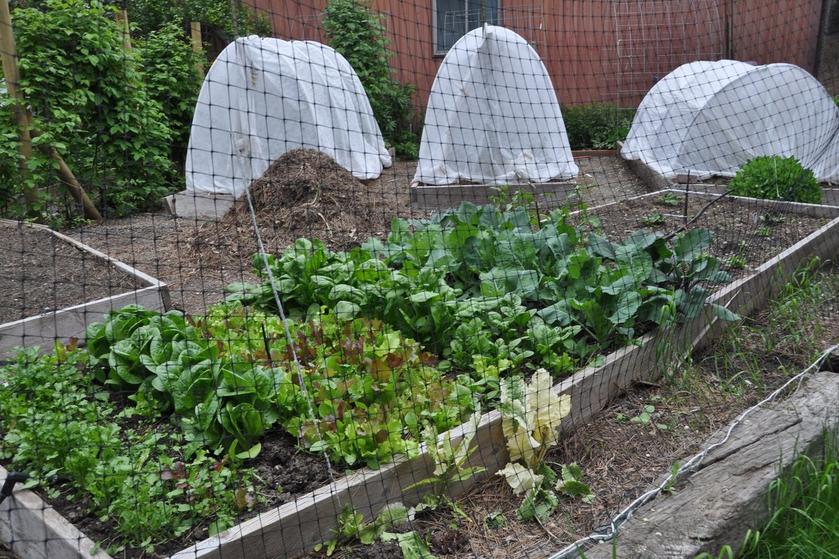
If you do want to gamble with the frost dates, be prepared to cover plants on a moment’s notice. Keep tarps and sheets handy in the garden to protect plants from a mild frost (28 to 29 degrees). Remove the tarps in the morning. A more permanent method is to place PVC pipe hoops set on rebar ground pins over the plants and cover the hoops with floating row cover. This not only protects the plants from light frost but keeps them warm during the day, so they grow faster.