This column reflects the opinion of the writer. Learn about the differences between a news story and an opinion column.
Getting There: As traffic backs up and becomes unsafe on Highway 195, transit planners search for an off-ramp
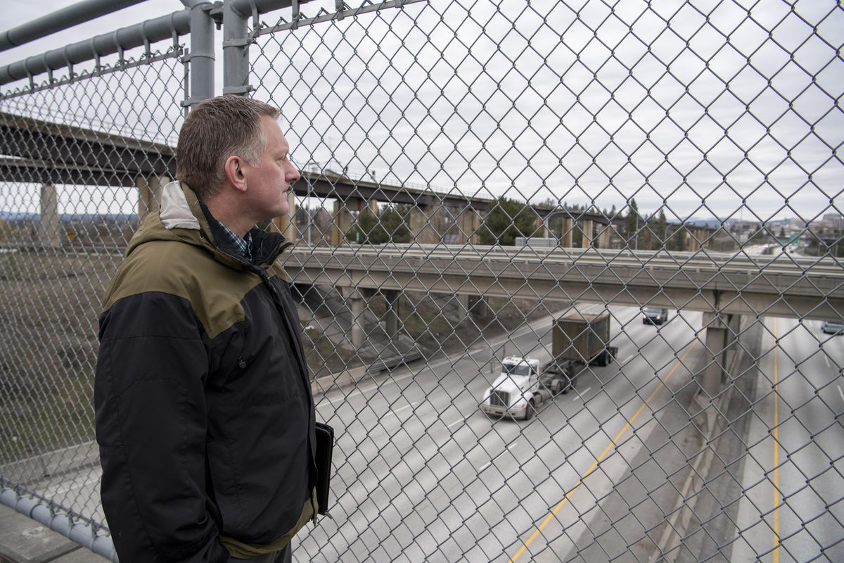

It was hard to hear Ryan Stewart over the din of traffic passing seemingly on all sides.
Stewart was standing over Interstate 90, across from a pair of Highway 195 bridges, below the Y-shaped railroad viaducts spanning Latah Creek, and on the Fish Lake Trail bridge, talking about the enormous need – and cost – of improving the transportation infrastructure and flow at the increasingly busy interchange.
“There’s recognition that something’s going to have to happen,” said Stewart, the Spokane Regional Transportation Council’s principal transportation planner and the manager of a new study that aims to figure out what that “something” might be.
And if you want to know why something needs to happen at the junction of I-90 and Highway 195, Spokane County Commissioner Al French says you can easily see for yourself.
“If folks don’t understand the need, all they have to do is be at the intersection of 90 and 195 between 7:30 and 8:30 a.m. on a weekday,” French said.
A resident of Eagle Ridge, one of the proliferating developments that have come to the Highway 195 corridor over the past two decades, French said he’s found himself waiting south of 16th Street, some 20 blocks away from the interchange, in a line of cars, all trying to get to the on-ramp.
“I know that backup is real, because I’ve had to sit in it,” French said.
French and Stewart are far from alone in their knowledge of how big the problem is and how urgent a fix is.
Just last week, a city of Spokane hearing examiner told a developer that a planned 98-home subdivision can only include 20 homes until the Washington State Department of Transportation makes improvements to Highway 195.
But according to WSDOT, the burden of dealing with traffic issues in the area should not be the department’s to bear alone. In fact, Mike Gribner, administrator of the department’s Eastern Region, says the city made “commitments” to start improving the area road system some 15 years ago – improvements that would have gotten ahead of the problems that now threaten to stifle development in the area.
Gribner traces the origins of those commitments to the early 1990s, when WSDOT allowed the city to extend sewer infrastructure in the department’s right of way to allow for the initial major development of the then-rural area.
Then in 1999, soon after that sewer line was laid and work on Eagle Ridge began, an engineering study described a number of potential changes designed to alleviate future congestion, including adding interchanges at Hatch, Meadowlane, Thorpe and Cheney-Spokane roads and building two new frontage roads. One of those roads would have traveled from Lindeke Street down to Cheney-Spokane Road following the Fish Lake Trail right of way, said Inga Note, senior traffic planning engineer for the city of Spokane. A second frontage road was planned to run from Eagle Ridge Boulevard to Hatch Road.
Of those proposals, only the Cheney-Spokane interchange is a reality, though a J-turn was also added at Thorpe road.
Whether those 1999 proposals were possibilities or obligations depends who you ask.
Note said they were informal and that, while “everyone was in agreement” that it would be good to pursue the improvements, funding never materialized.
“All the money in the region has gone to other projects like building the North Spokane Corridor,” Note said. “So it’s not something that’s been a high enough priority at the state level to put funding to it.”
But Gribner disagrees, saying it was the city’s job to take the lead on the projects. He said “there were ongoing commitments that the city of Spokane should have honored and WSDOT should have been able to rely on, including city of Spokane’s comprehensive plan, letters and conversations between WSDOT and city of Spokane leadership.”
“Now, those things didn’t get built for the most part, and we find ourselves several years later with a bigger problem and we need to address it,” Gribner said.
That’s something Gribner and Note do agree on: that the important thing now is to move forward and make those solutions – or something similar – a reality.
While Gribner says there’s still capacity on Highway 195 itself, it’s the road’s connections that are the big problem. Foremost among those connections – and problems – is the road’s eastbound on-ramp to I-90.
He says between 21,000 and 22,000 vehicles get on the interstate at that interchange each day, with about 10% of that during the peak morning and evening commute.
Last year, WSDOT installed Spokane’s first ramp meter in an effort to ease issues with vehicles entering I-90 eastbound from the Highway 195 on-ramp. That signal directs drivers to either stop or go as they enter the interstate, regulating the frequency of merging vehicles and aiming to improve the flow of traffic.
But the “ramp meter is not a solution, it’s simply managing the connection there,” Gribner said.
Solving the interchange issues would entail not only improving the on-ramp, which doesn’t meet current design standards, but also widening at least one of the aging interstate bridges crossing Latah Creek. And widening the eastbound bridge would, in turn, affect the Maple Street off-ramps, requiring them to be redesigned and rebuilt in a braided pattern.
All together, the fix is a mindbogglingly expensive and long-term prospect, one that will likely cost “in the $450 million range,” according to Gribner.
A project that expensive would have “to become a political and public priority” and would have to compete with other major projects statewide before the funds would be allocated, Gribner said. So far, WSDOT doesn’t even have the funding available to design such a project.
With all those considerations, Gribner said such a project would take at least six to eight years to complete.
“And that would be about as optimistic as I could be,” Gribner said.
In the meantime, Gribner, Stewart, Note and other planners from their agencies, Spokane County and the Spokane Transit Authority, are trying to figure out what they can do.
The public part of that process begins Monday at 6 p.m. at St. John’s Lutheran Church, where all are invited to both learn about the study, offer their input and pinpoint areas of concern.
Stewart and SRTC, the region’s lead transportation-planning agency, have been getting the ball rolling behind the scenes, along with its study collaborators.
Many of the options they’re considering are the ones laid out back in 1999, including adding new frontage roads and interchanges to improve what Stewart calls “local network connectivity.” That’s planner-speak for what boils down, Stewart says, to “giving people options” for how to travel downtown and elsewhere “without having to get on 195.”
But those options are limited, and it will be costly to make them a reality.
Take, for example, two projects already on the radar of planners: new interchanges at Highway 195 and Meadowlane and Hatch roads. There are “big safety concerns at both of those locations,” Stewart said, but adding new interchanges would cost an estimated $20 million to $40 million. Each.
Other ideas for boosting the infrastructure include creating overpasses or underpasses at Thorpe Road and 16th Avenue.
Not every improvement would involve pouring concrete and putting shovels in the ground, though.
Stewart says congestion and safety problems could be alleviated, if not solved, with other approaches, such as boosting bus service, creating variable speed limits along I-90 to improve flow, or offering developers incentives to add amenities that would decrease how often residents have to leave the area in their cars.
“There has to be a focus on reducing those trips,” Stewart said of travel on Highway 195. “That’s the hard reality.”
But that’s a hard end to achieve.
While the city did limit the most recent plan for more houses in the area, most everyone believes there’s still a strong appetite for more development and that the corridor is a prime place for a growing city to grow. So the agencies coming together to pursue first a study, then money, and then changes, will have to balance their competing interests in order to move forward.
WSDOT’s primary interest is preserving Highway 195 as a highway of national and state significance and as a freight route. Keeping it that way and maintaining “the safety of the public” on the road “will drive our decision-making,” Gribner said.
But while WSDOT hopes to move cars off the highway and onto city streets, new and old, Note said that can lead to new problems. After J turns were installed at Thorpe Road, for example, “we saw an increase in traffic at Inland Empire Way going into town,” Note said.
“I want to come up with a solution that’s safe and meets everybody’s goals, and I don’t know exactly what that’s going to be,” Note said. “But for us, it would be for people to develop within the city limits like they’re zoned for. And for DOT, they want to minimize the local traffic on the freeway system and keep that open for freight and reduce the crashes.”
She also said the interests of the city and WSDOT ultimately overlap: “We have the same goal in that we want to find a solution that makes everybody happy.”
It will take time for that to happen, though.
Stewart and his fellow planners are hoping the study will be complete within about 18 months. When it is, the results will be incorporated into the long-range plans of the participating agencies. Those agencies will then prioritize projects and seek funding.
And that, Stewart said, is what it “ultimately comes down to”: going out and getting money to make the fixes. Short-term solutions could start being implemented within a couple of years, Stewart said, but it will likely be 10 to 20 years before something like a total solution, including improving the interstate, is a reality.
“We’re trying to be proactive,” Stewart said. “But we’re behind the curve a little bit.”
I-90/North Spokane Corridor interchange update
A team from the Washington State Department of Transportation will meet with members of the public on Thursday to preview and discuss proposed changes to how the North Spokane Corridor will eventually join I-90 near the Liberty Park interchange.
The meeting will also cover a recent noise study, how the NSC and I-90 will connect to local roads and an update on the Children of the Sun Trail shared-use path, which will run parallel to the NSC and connect to the Ben Burr and Centennial trails.
WSDOT expects the NSC’s entire 10 1/2-mile stretch linking I-90 to highways 2 and 395 to be complete by 2030, though fallout from passage of Initiative 976 could delay that. So far, about half of the span is open to traffic.
The meeting will run from 5-7 p.m. at the East Central Community Center, 500 Stone St. A formal presentation will begin at 5:30 p.m., followed by a question-and-answer session.
Work to watch for
The west curb lane of Stevens Street between Main and Riverside avenues will be closed through today for CenturyLink work.
The eastbound curb lane of Wellesley at Belt will be closed and Belt will have a lane shift south of Wellesley through Tuesday for Quanta work.
The northbound lane of Driscoll Boulevard just south of Wellesley will be closed until Feb. 21 for Avista to replace a damaged pole.
Hartson Street between C and D streets will be completely closed through Wednesday for construction work.
The westbound curb lane of Riverside Avenue between Browne and Bernard streets will be closed through Wednesday for Quanta work.
The north curb lane of Third Avenue between Jefferson and Wall streets will be closed until Tuesday, Feb. 18, for Quanta work.