Rich Landers: $16 million stream restoration project benefits fish, and hikers too
The newest trail project on the Colville National Forest near Sullivan Lake offers hikers a trip down memory lane. Each step leads to lessons ranging from industrialization to ecosystem recovery, with the occasional deer or bear sighting along the way.
A three-year, $16 million stream restoration project – in a partnership involving Seattle City Light, the Pend Oreille Public Utility District and the U.S. Forest Service – has dramatically changed the Mill Pond Historic Site. The reservoir has been drained, the dam removed and a portion of Sullivan Creek has been reestablished much as it was around 1900.
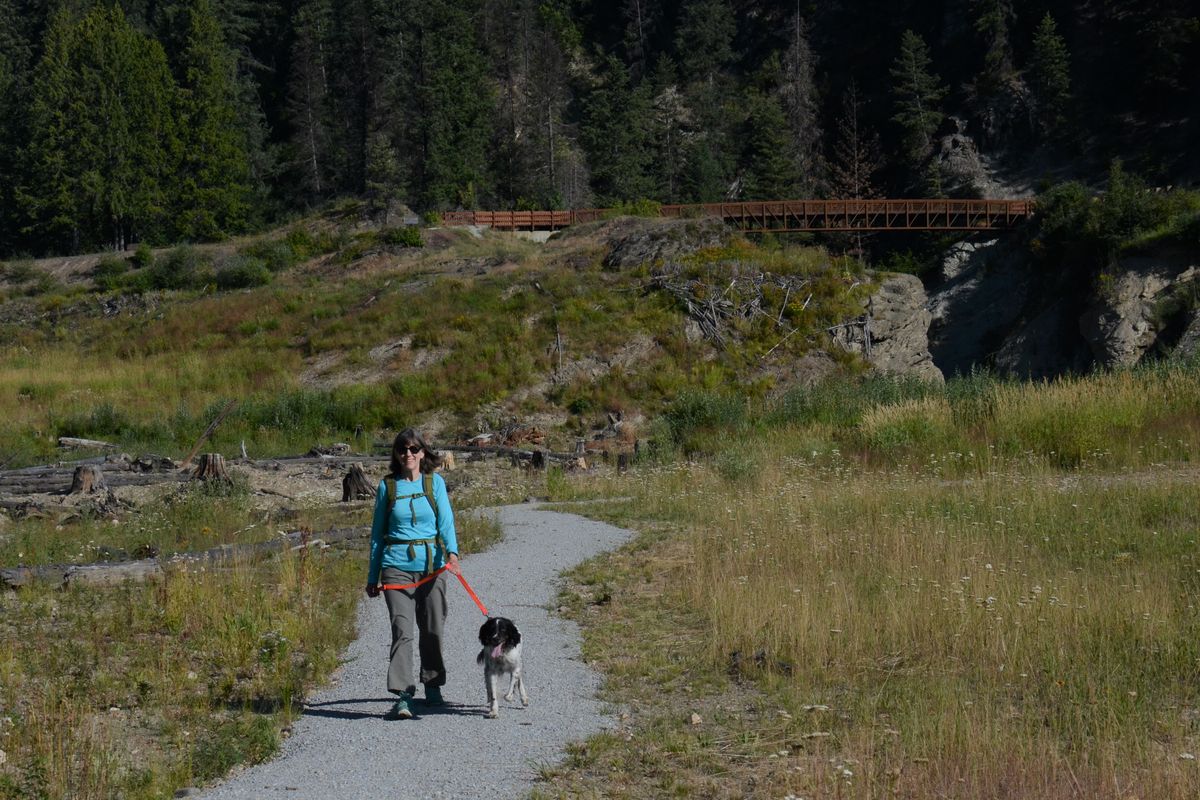
A new picnic pavilion has been built and a trail system links with Mill Pond Campground, which was upgraded and reopened last month. The new trails include two dramatic bridges and a new interpretive loop through some of the stream reclamation. A bridge links to the former Flume Trail that winds through the remains of a camp where workers staged more than a century ago to build an ambitious hydropower facility.
Trail signs are yet to be installed along the new Flood Plain Loop Trail, but the route is easy to follow and visitors are encouraged to inspect the early stages of stream recovery and follow its evolution.
“Come and see it now,” recommended Lloyd Dixon, Seattle City Light’s Mill Pond Project manager. “In five years, nature will take over and the flood plain habitat will grow up dramatically.”
Mill Pond Dam was built starting in 1909 to store water for a roughly 3-mile-long wood flume to a hydropower facility primarily for a cement plant at Metaline Falls.
While the dam had not been used for hydropower or flood protection since 1956, it remained a man-made barrier to fish passage.
Eliminating Mill Pond dam in 2018 paved the way for fish passage to most of the Sullivan Creek watershed’s 58 miles of fish-bearing stream for native species including westslope cutthroat trout and endangered bull trout.
The restored creek also lengthens and enhances a seasonal run for expert kayakers.
Sullivan Creek fisheries also are benefiting from cooler water during summer. The PUD installed a 48-inch pipe system that feeds water into Outlet Creek from the cool depths of Sullivan Lake rather than draining warm surface water from the spillway. Outlet Creek flows into Sullivan Creek downstream from the lake and upstream from the Mill Pond site.
These developments are among a suite of regional native fish restoration measures that also tag on recreation improvements funded by Seattle City Light through agreements required for federal relicensing of Boundary Dam on the Pend Oreille River.
Trailheads for the Mill Pond project trails are at the historic site as well as at the campground, which includes day-use parking for about six vehicles.
The most versatile access for noncamping hikers is the Mill Pond Historic Site, a hub for all of the Mill Pond trails plus the Elk Creek Falls Loop Trail north of Sullivan Lake Road. Park at the picnic pavilion or farther down at the end of the access road along the fence.
To hike all the project’s trails, start with Flood Plain Loop Trail, which descends into an area that formerly was inundated by the 64-acre reservoir. The 1-mile loop gives visitors a close look at vegetation succession that will continue for many years.
A spur in the loop leads to a view of the new footbridge that crosses the gap in the granite walls where the 134-foot long, 55-foot tall concrete dam stood for 108 years.
The trail winds through new plantings that include Douglas fir, Pacific willow, red twig dogwood, Sitka alder, snowberry, sandbar willow, lady fern and water sedge. Seeds for the locally sourced plants were collected in 2015 before the restoration work began and raised in a nursery for planting along the restored stream ecosystem, Dixon said.
The stream course includes side channels – some created by machinery and some by nature in a well-timed 2018 spring flood during restoration. More than 70 jams of logs hauled in by helicopter and installed with heavy equipment are creating fish habitat. The structures will snag other woody debris to create wetlands as the channel migrates over time. The woody materials slow stream flow and create hiding places for fish.
After finishing the Flood Plain Loop Trail back to the lower parking lot, head for the bridge over the old dam site. Enjoy the view before continuing onto Mill Pond Flume Trail. Bear right at the first junction as the trail loops by old structures and signs with historic photos of the flume that once funneled water over the creek bed some 3 miles to Metaline Falls.
The trail weaves past sites once occupied by a blacksmith shop and outhouse plus the caretaker’s cabin. The camp was established in 1909 for workers who sawed logs and used steam-powered pile drivers to construct the flume.
A fascinating aspect of the wooden flume is that the top covering created a walkway that locals adopted as an easy-grade boardwalk from town up to the Mill Pond, speeding the trek to beautiful Sullivan Lake.
The flume caretaker had to be creative for the never-ending maintenance. For instance, his daughter is quoted in a sign as saying he used a .405 caliber rifle to shoot down huge icicles that formed on the flume, and sometimes he came home with a bruised shoulder from his work. Incidentally, a Winchester .405 that Theodore Roosevelt dubbed as “Big Medicine” was the president’s choice for hunting big African lions.
The flume eventually was doomed by high maintenance to deal with structure failures and leaking. It was rebuilt entirely in 1920 and 1937 but finally abandoned in 1956. Locals probably salvaged some of the valuable cedar lumber while most of the rest has rotted away, Dixon said.
The Flume Trail eventually connects with Sullivan Creek Trail. Turn left and head back to the Mill Pond parking area for a round-trip hike of 0.9 miles. Or turn right on Sullivan Creek trail for a longer loop around the entire project.
Most of the Sullivan Creek Trail is wide, a former road. After about a half mile, watch for a single-track South Mill Pond Trail that goes down left toward the creek. The spur is a nice walk, 0.7-mile round trip.
Continuing east, Sullivan Creek Trail eventually curves north on new construction that leads to the stunning new 180-foot steel bridge across the creek near the top end of the reclamation project. The bridge leads to the day-use parking lot and trailhead at the rebuilt Mill Pond Campground.
To continue the Mill Pond loops, follow the paved road through the campground (passing the vault toilet) to the turnaround circle. Here you can take the spur left and down to the creek before heading west on the trail marked Elk Creek Falls. The second bridge you cross is over the cool spray of Elk Creek.
At the junction with Elk Creek Trail, you can head uphill and across Sullivan Creek Road to explore the 2.1-mile loop that visits Elk Creek Falls. Or you can continue contouring west above Sullivan Creek back to the Mill Pond Historic Site parking area. At a junction, the right fork heads up to the picnic pavilion parking area (and another trailhead for Elk Creek Trail). The left fork leads down a short way to the lower parking area and Flood Plain trailhead.
Hiking the Mill Pond Flood Plain Loop Trail, Flume Trail, south spur trail and returning to the historic site parking lot on the trail from the campground is 4.7 miles.
While some locals have grumbled about losing the Mill Pond they grew up with, the defunct dam had to be dealt with sooner or later. Sparsely populated Pend Oreille County didn’t have the money to do it until Seattle City Light identified the project as a way to satisfy some of its mitigation requirements for relicensing Boundary Dam. The arrangement was a good deal financially for both Pend Oreille County and Seattle ratepayers, spokesmen for both entities say.
“The Mill Pond Dam removal is one of several habitat restorations City Light is performing in the Sullivan Creek watershed,” said John Armstrong, Seattle City Light Boundary Licensing Manager. “Collectively, these projects will help restore native salmonids in the Sullivan Creek and the Boundary reservoir.”
The utility contracted with Natural Systems Design of Seattle for the engineering and Montana-based Envirocon as the contractor for the stream reclamation. Envirocon has a wealth of experience, including the restoration work involved with the removal of Mill Town Dam on the Clark Fork River upstream from Missoula.
The Mill Pond Dam-Sullivan Creek project was designed to let nature do most of the work with only minor needs for maintenance, Colville National Forest information officer Starr Farrell said.
“It was an incredible team effort,” Dixon said. “We were given a lot of freedom to create the system. I was lucky enough to be the project manager.”
The project is a career highlight, he said.
“I’ll be able to bring up years from now on Google Earth and proudly tell my grandkids, ‘I was involved with that.’ ”