Outdoor tech: Detailed waterways info and GPS in single smartphone app

Michael Gogal realized that a giving anglers and paddlers mobile access to waterway maps, GPS features and USGS flow information could make venturing out on rivers and lakes safer and more productive.
The trick was to create the app without drowning in a flood of data.
“I like to fish remote streams,” he said, citing the genesis of Stream Map USA. “I’m using apps all of the time. I made this one because it wasn’t out there.”
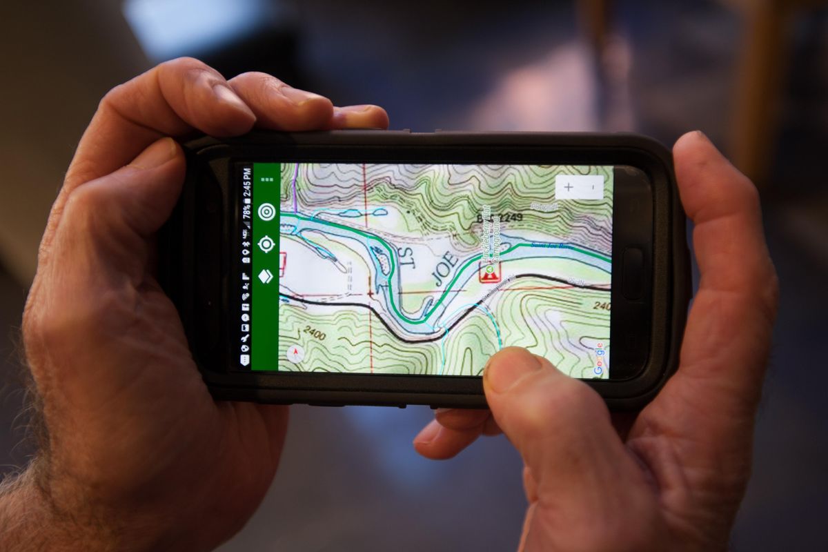
Stream Map USA is a searchable, color-coded river, lake and stream map that can be viewed over road maps, satellite images and high resolution 1:24,000 scale U.S. Geological Survey topographic maps.
Development didn’t happen overnight.
The Philadelphia app creator and angler recalled visiting the office of a fisheries biologist and seeing a detailed watershed map on the wall made by a Penn State University professor. “It captivated me with its incredible color and detail on every stream and tributary in Pennsylvania,” Gogal said.
He was inspired to do a digital version for the 48 continuous states.
“The data is out there,” he said. “States list streams that have fish, but then you have to find maps and hope every stream is on them.
“Google Maps are weak on detail for streams and they miss a lot of rural roads. I had to start my computerized mapping with USGS 24K maps and go from there.”
He went from there for more than three years.
“The biggest challenge was the scope of the data,” Gogal said. “Millions of individual pieces of stream lines had to be merged.”
A unique feature of Stream Map USA are the colors used for rivers, streams and tributaries.
For example, the North Fork of the Coeur d’Alene River is green from headwaters to mouth. Cataract Creek, a tributary, is purple, and West Elk Creek, a trib to Cataract Creek, is red.
An angler hiking up a remote stream or a paddler floating down can use the GPS feature to pinpoint his location and quickly see the tributaries. They stand out distinctly as opposed to traditional maps that show blue lines for all streams.
“Say you’re wading upstream and come to a fork,” Gogal suggested. “Pull up the app. The blue stream I searched for goes right. That means the stream to the left is a tributary.
“This also is very useful for boaters on big lakes to cruise the shoreline and identify tributaries.”
Providing the distinctive features tested Gogal’s patience. Coloring of each stream had to be done manually.
“I devoted months and months and months to coloring, reminding my self regularly that I only had to do it once,” he said.
For search purposes, he also has designated some 300,000 waters as River or Stream.
After three and a half years, he had his product for iPhone, iPad and Android on the market through the App Store and Google Play.
“I don’t have to shop for maps anymore,” he said. I can search for a stream, select a map option or satellite image, hit a button, see it and then zoom in or out as needed.”
Specialized paper maps for specific streams showing put-in and take-out spots continue to have a definite role for planning fishing and floating trips.
But the Stream Map USA app will give turn-by-turn driving directions to a designated spot on a river. When out on the stream, a user can tap the GPS feature to pinpoint his exact location.
By adding waypoints as you head out, the map will show the location of your parked car, camp or fishing hot spot.
Then, if needed, a compass can be pulled up to navigate to that waypoint.
With or without cellular service, you can create and edit custom waypoints for planning purposes or save important destinations for future access. Waypoints are created by capturing your current location, entering GPS coordinates or with a simple touch of the map.
Boaters can set a destination as a waypoint and the app will show the distance on the compass feature as well as the heading and approximate speed of travel.
Every USGS stream flow gage is indicated by a colored pin. Tap one of the pins and the app links directly to the USGS website for that stream gage and real time flow information and flow history.
“You don’t have to know the number or name of the gage to access the online data,” Gogal points out.
A data connection is required for searches but the GPS works without a cellular signal. Put the phone in airplane mode to save battery power.
“We’ve also included seamless USGS 7.5 minute topographic maps, road maps from the OpenStreetMap project and the option to view stream data over a plain white background,” Gogal said.
Both USGS and OpenStreetMap can be stored locally on an Android along with the Stream Map for use in the field when cellular service is not available.