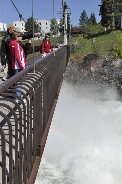
Spokane River rises to flood stage
Spokane Falls roaring this week with spring melt

Warmer temperatures are expected today and Friday with the cooler, wet weather dropping into the southern Rockies.
Highs today should reach 73 in downtown Spokane and 75 in Coeur d’Alene with mostly sunny skies and light west winds.
Temperatures a few degrees warmer are expected on Friday with partly sunny skies.
Lows are expected to run in the upper 40s to lower 50s through Sunday.
A chance of showers returns for the weekend as the persistent low pressure system over the western U.S. brings another shot of potential moisture and cool air from Sunday through Tuesday.
The Spokane River was approaching flood stage this morning and was running at 32,400 cubic feet per second, the highest flow since 2008. The high flow is expected for the next several weeks.
Most other area rivers have crested and were falling and Lake Coeur d’Alene has apparently stopped rising about a half foot below flood stage.
However, National Weather Service forecasters said rivers and lakes may rise again by the end of the weekend due to the warmer weather currently.
The Pend Oreille River is expected to rise through early next week and reach the action stage for flood concern of 85,000 cfs, the weather service said.
At 7 a.m., it was 47 at Spokane International Airport, 45 at Felts Field, 4 in Coeur d’Alene, 44 in Deer park and 48 in Pullman.