Storms target flooded Vermont, Northeast after spawning Chicago tornadoes
After enduring severe flooding Sunday and Monday, Vermont and the broader Northeast braced for another round of torrential rain Thursday as the same storm system that unleashed tornadoes in the Chicago area Wednesday evening plowed eastward.
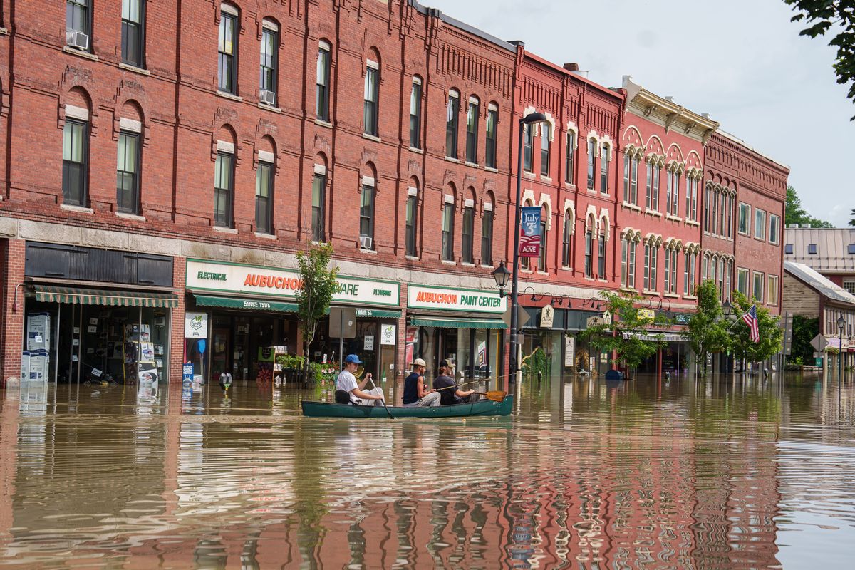
The threat of more extreme weather in the region comes just two to three days after Vermont suffered one of its worst floods in a century.
Vermont Gov. Phil Scott (R) said he would submit a request Thursday to President Biden for a federal disaster declaration, a separate step from the emergency declaration Biden issued while traveling in Lithuania and one that Scott said would get federal disaster recovery money flowing “almost immediately.”
Vermont officials said they were meanwhile bracing for more flash flooding from storms forecast Thursday afternoon and evening, as well as from widespread rain expected Saturday, and urged residents to remain vigilant. “This isn’t over, and it won’t be over after this storm,” Scott said.
The National Weather Service hoisted a Level 3 of 4 risk of excessive rainfall on Thursday across southern Vermont and parts of eastern New York. A larger Level 2 of 4 threat surrounds it from central New York to the western border of Maine.
Up to several inches of rain were expected Thursday in the Northeast on top of saturated ground that cannot take in any more water. Additional heavy rain and flooding also could occur into the weekend.
“Streams and rivers are still running fast and high, and the soil is saturated and unable to take more rainfall,” wrote the Weather Service office in Burlington on Thursday.
Additionally, a severe thunderstorm watch is in effect for Vermont and much of New York until 8 p.m. Thursday. There’s a high likelihood of wind damage within the watch zone. A tornado was observed early Thursday afternoon in Barrhaven, Canada, near Ottawa.
Tornado-producing system heads toward Northeast
A zone of low pressure between the Great Lakes and Hudson Bay has been flinging storm systems eastward for several days, including the one that caused the severe flooding in the Northeast on Sunday and Monday. The most recent wave triggered a slew of tornadoes Wednesday evening in the Midwest. It’s headed into the Northeast.
On Wednesday evening, several tornadoes were confirmed on the west side of Chicago. Damage has been limited, but in some cases significant. Elgin – about 35 miles northwest of Chicago and Lyons – about 12 miles to the southwest – were particularly hard hit, both seeing damage to homes and businesses.
A tornado was reported by observers at Chicago Midway Airport, where a ground stop was issued for a time. The same thing occurred at O’Hare International Airport. Other tornadoes were reported in western Iowa and southern Michigan, in addition to numerous wind damage reports across the region.
As the storm system enters the Northeast, turbulent weather is set to linger off and on into next week.
Thursday flood risk
Scattered showers were moving through parts of New York and New England early Thursday. None of this activity was terribly heavy, but it’s only the first of what could be several waves.
Unusually high moisture levels in the atmosphere may join forces with a slow-moving cold front to deliver rainfall rates of 1 to 2 inches per hour. If storms repeatedly pass over the same location, it won’t take long for more flooding to initiate.
The Weather Service anticipates up to 5 inches or more in the hardest hit spots. “Within the [Level 3 of 4] risk area, expect several instances of flash flooding and impacts due to rapid runoff,” it wrote.
Parts of the Northeast are also likely to experience severe thunderstorms Thursday afternoon and evening. The Weather Service has declared a Level 3 of 5 risk for damaging storms in much of Upstate New York to the Vermont border region. An area around that extends from the international border southwestward through much of Pennsylvania and into the eastern Ohio Valley.
In addition to flooding, the primary threat from this activity is the potential for wind gusts that may topple trees and cause other damage. Much of eastern New York and the Hudson Valley are also under an elevated threat for a few tornadoes.
Friday may produce more storms, flooding
As a cold front serving as the focus for rainfall drifts south into Friday, the heaviest downpours should tend to shift south and east of Vermont.
The Weather Service has placed much of Southern New England and New Hampshire into southwest Maine under a Level 2 of 4 excessive rainfall risk. However, a few heavier storms could still flare up in Vermont, especially in the southern part of the state.
“A few gusty t-storms are possible across southern areas,” wrote the Weather Service in a Thursday morning discussion. “The main threat will once again be flooding downpours.”
The weekend into next week
Heading into the weekend, the meandering frontal zone is forecast to drift north as a warm front Saturday, bringing back the potential for more flooding downpours in Vermont.
Although forecast confidence is lower further out in time and some changes are possible, additional rounds of heavy rain could develop on Sunday and around the middle of next week.
“These waves of precipitation are expected to continue through the end of the long term,” wrote the Weather Service in Burlington.
The Weather Service’s Climate Prediction Center favors above normal rainfall in the Northeast for the next few weeks.
- – -
The Washington Post’s Scott Dance and Jason Samenow contributed to this report.