How the Earth’s tumultuous history gave the Mid-Atlantic its beloved destinations
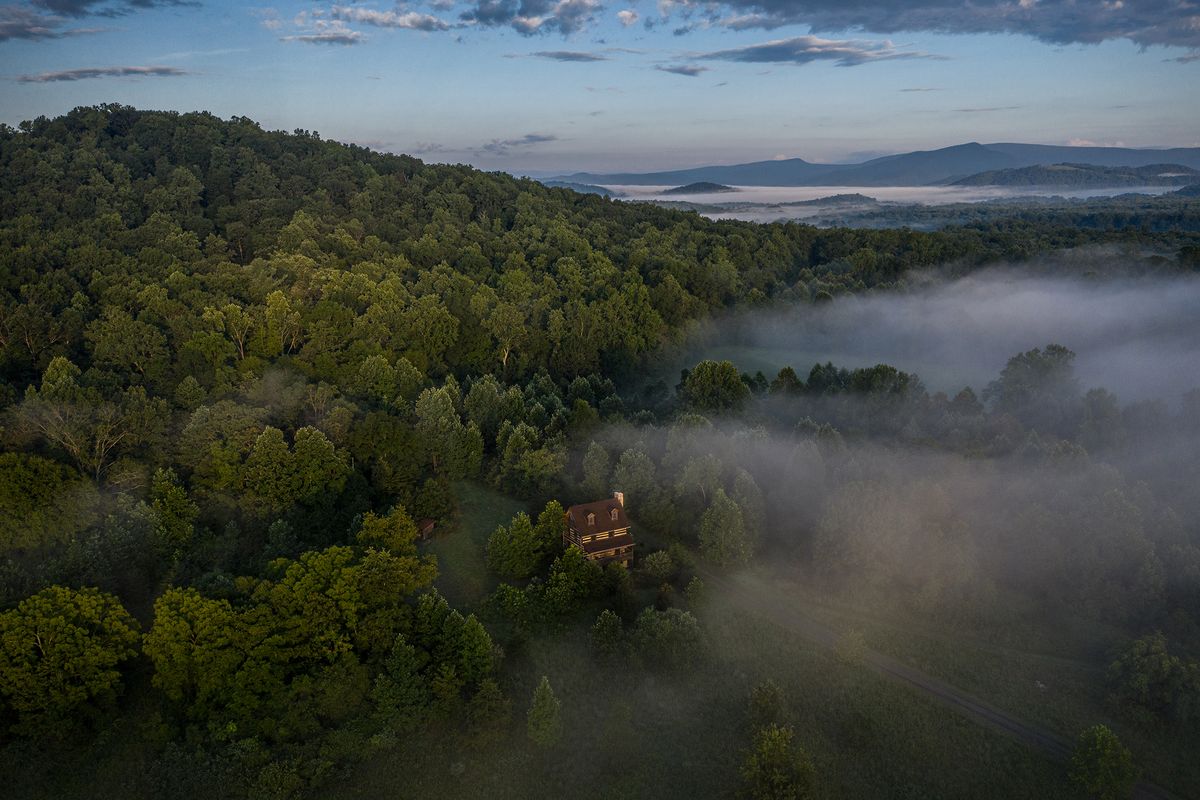
The 9½-mile loop trail to the top of the Blue Ridge’s Old Rag Mountain and back is Shenandoah National Park’s most popular hike in Virginia, according to the National Park Service.
The steep climb is challenging – scrambling over and squeezing between boulders in several places – and once you’ve conquered the Old Rag summit (elevation 3,284 feet), “you feel like you’re on top of the world,” in the words of the park service website.
While you’re taking in the scenic view from the top of Old Rag, your hands hold tight to the craggy peak’s outcroppings and boulders. You don’t want to fall. But take a moment to feel, really feel, the rough surface of the weathered granite.
Touch it intentionally with your hands and fingers, and reflect on the fact that it emerged as molten rock from under the Earth’s surface a bit over 1 billion years old, which is about when primitive, multicellular organisms – the origins of life as we’ve come to know it – first appeared.
Does that lessen its majesty? Poet John Keats once said Isaac Newton destroyed the poetry of the rainbow by explaining the prismatic reasons for its brilliant colors. But I believe the more you learn about a landscape’s “beauty secrets,” the more enchanting and seductive it becomes.
If you immerse yourself in the vastness of what’s beneath the surface and become an amateur geologist, you can travel far back in time and discover a new intimacy and connection with the familiar summer playground that is the Mid-Atlantic region.
Let’s start with Old Rag. The granite on its top began as molten rock deep underground. Earth’s powerful tectonic plates pressed together, and, as the pressure increased, the magma slowly ascended and crystallized into the Old Rag granite of today.
It was the result of the first of two mountain-building events that resulted in today’s Blue Ridge – the Grenville orogeny of 1 billion years ago. And now it rests atop mountains formed by a much later event – the Appalachian (or Allegheny) orogeny, which occurred 300 million years ago – giving witness to the planet’s many epochs.
But we’re getting ahead of ourselves. About 600 million years ago, the same tectonic plates that created the Old Rag granite started pulling apart. The thinning, flattening crust created a shallow rift that filled with water, which geologists call the Iapetus Ocean.
Water meant marine life, with calcium-rich shells and skeletons. Their sedimentary remains formed the building blocks of limestone and other soluble rocks. As these rocks dissolved, caves and caverns were carved out over an enormous length of time – measured not by the tick-tock of clocks but by the drip-drip of water – forming the Shenandoah Valley caverns.
The valley, named for the river, separates the Blue Ridge from the main Appalachian chain. Of the seven caverns open to the public and readily accessible from Interstate 81, Luray Caverns is the largest. Among its attractions is a “Stalacpipe Organ,” played on a regular organ but whose organ pipes are stalactites wired with small rubber mallets spread over 3½ underground acres.
To paraphrase a quip about history often attributed to Mark Twain, geological events don’t repeat themselves, but they often rhyme. So, it was that about 300 million years ago, tectonic plates again squeezed together – this time to create a supercontinent called Pangea.
The name derives from the ancient Greek “pan” (“all”) and “gaia” (“land”). You can see today on any world map how Africa and the Americas once fit together as if pieces of a giant jigsaw puzzle.
But today’s most visible on-the-ground evidence of the colliding land masses are the mountain ranges running from Georgia to Maine that arose during the Appalachian orogeny.
Here in the Mid-Atlantic, we have the Blue Ridge Mountains, which pushed the Old Rag granite upward, so it sits atop the mountain today. They get their name from their hazy blue appearance when seen from a distance.
While we know them as weathered, sculpted and rounded, the Blue Ridge at creation had elevations and topography like today’s Alps and Rockies. Along their now-soft spine runs the 469-mile Blue Ridge Parkway, offering spectacular scenery as it links Virginia’s Shenandoah National Park and North Carolina’s Great Smoky Mountains National Park.
The Atlantic Ocean came into being when Pangea split apart, and the rainfall spilling off the Appalachians rushed downhill, helping to fill the new sea. These rivers carried sediments from the ever-shrinking mountains to be deposited in what would become part of the Atlantic coastal plain.
Virginians call this area the Tidewater region because of the tides’ effect on the low-lying land. The Mid-Atlantic’s summer beach destinations wouldn’t exist without this coastal plain.
Perhaps the most defining geological feature for early European settlers in the Mid-Atlantic was the fall line that separates the Atlantic coastal plain from the Piedmont.
From the Italian “Piemonte,” meaning “foothills,” this gently rolling landscape is all that remains of once-mighty parts of the Appalachian chain. Oceangoing ships could easily navigate the rivers’ tidal stretches but could go no farther than the falls or rapids they encountered upstream.
That explains why many of the region’s early cities and commercial hubs are located where they are: Richmond on the fall line of the James River; Fredericksburg on the Rappahannock’s fall line; Georgetown and Alexandria downstream from the Potomac falls (Great Falls); Philadelphia on the fall line of Schuylkill; and Wilmington, Del., on the fall line of Brandywine.
Today, tourists are attracted by their colonial charm. Upstream above the fall line lies the Piedmont, which draws vacationers attracted by bucolic destinations and wineries.
Looking east from the top of Old Rag (or any Blue Ridge summit), you will see a few especially tall hills rising like lonely sentinels above the surrounding farmland. These are called monadnocks – after the eponymous mountain in New Hampshire – consisting of more erosion-resistant rock than their gently sloping, less elevated neighboring hill.
What comprises the Mid-Atlantic region can be open to debate, but perhaps the most geographically correct way of thinking about it is as the Chesapeake Bay watershed. The tiniest West Virginia tributary of the Shenandoah or Potomac eventually finds its way to the bay, as does all that flows into Pennsylvania’s Susquehanna. (Usually considered part of the Mid-Atlantic, Delaware uniquely has its very own bay.)
And of all the region’s major geological features, the Chesapeake is the newest – and a case study in climate change. The bay didn’t exist 10,000 years ago. Instead, the waters there were not of an expansive estuary but of a river – the Susquehanna – in its final stretch before flowing into the Atlantic. The Potomac, Rappahannock and James rivers were all Susquehanna tributaries.
This was during the last ice age. But when the glaciers melted, the sea level rose to flood and completely cover what had been the lower Susquehanna River valley. It’s easy enough to visualize what happened when you study a map of the Chesapeake watershed.
The largest estuary in North America, the bay is known for its beauty and bounty. Blue crabs and oysters are culinary delights. Its mix of fresh, brackish and salt water – together with mostly moderate winds and temperatures – makes it a magnet for sailors and fishermen. For history lovers, upstream from where the James River enters the bay is the site of the first permanent English settlement in the New World – Jamestown.
Climate change may have brought Chesapeake Bay into being, but now human-caused climate change endangers it – in both the short and long terms. Efforts are on to mitigate the effects of rising water on islands in the bay and the cities and towns along it.
But it’s difficult to envision what climate change means for the future. Will the entire coastal plain, together with its fall-line cities, inevitably be flooded? With the equally low-lying Delmarva Peninsula underwater, will the Chesapeake Bay itself cease to exist, subsumed by the Atlantic?
Will the ocean reach the mountains? With or without us, the Mid-Atlantic’s suspenseful geological narrative will continue.