
Mount St. Helens: Then & Now
For the 30th anniversary of Mount St. Helens’ eruption, Spokesman-Review photographer Christopher Anderson re-creates some of the images he captured May 18, 1980.
Section:Picture story
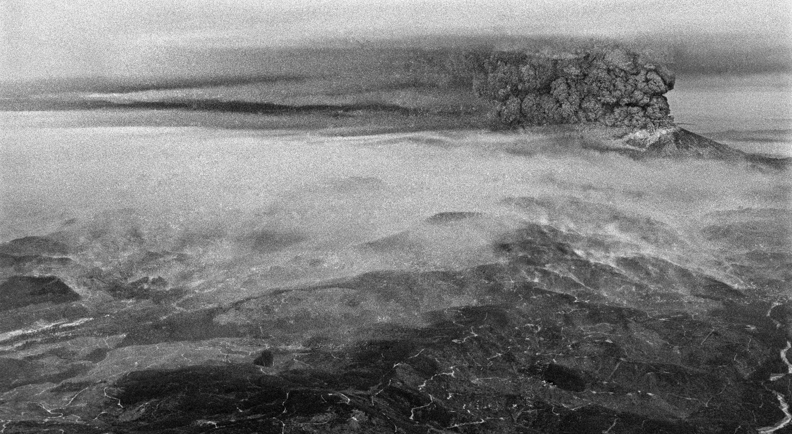
Approaching Mount St. Helens from the southwest on May 18, 1980, gave you a sense of the size and scope of the eruption.
Christopher Anderson The Spokesman-Review Buy this photo
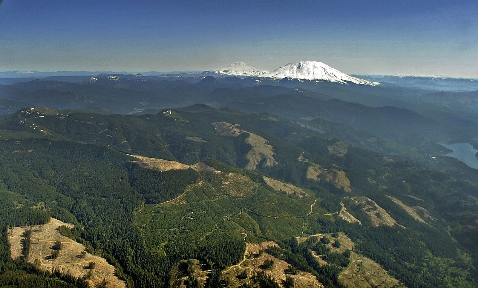
Mount St. Helens rises above lush evergreen forests that have sprung to life in the 30 years since the eruption. At rear is Mount Rainier.
Christopher Anderson The Spokesman-Review Buy this photo
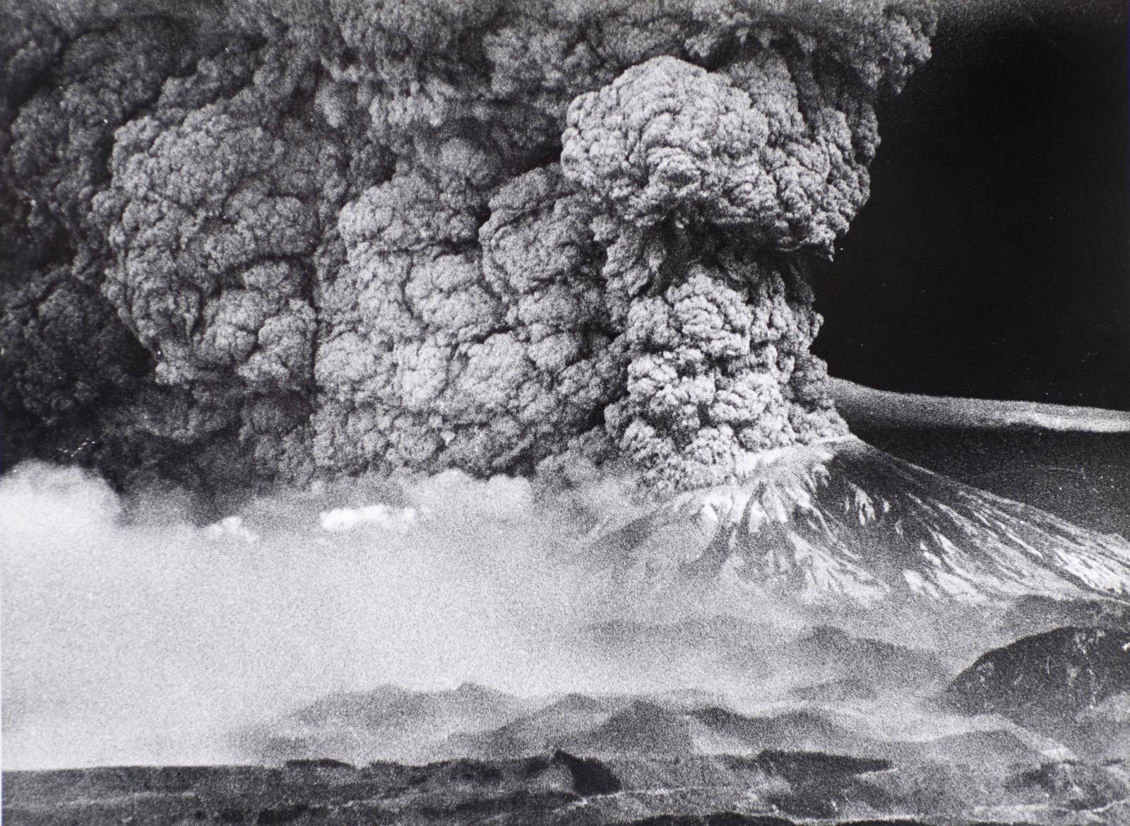
Mount St. Helens erupts, blanketing the region with ash and debris.
Christopher Anderson The Spokesman-Review Buy this photo
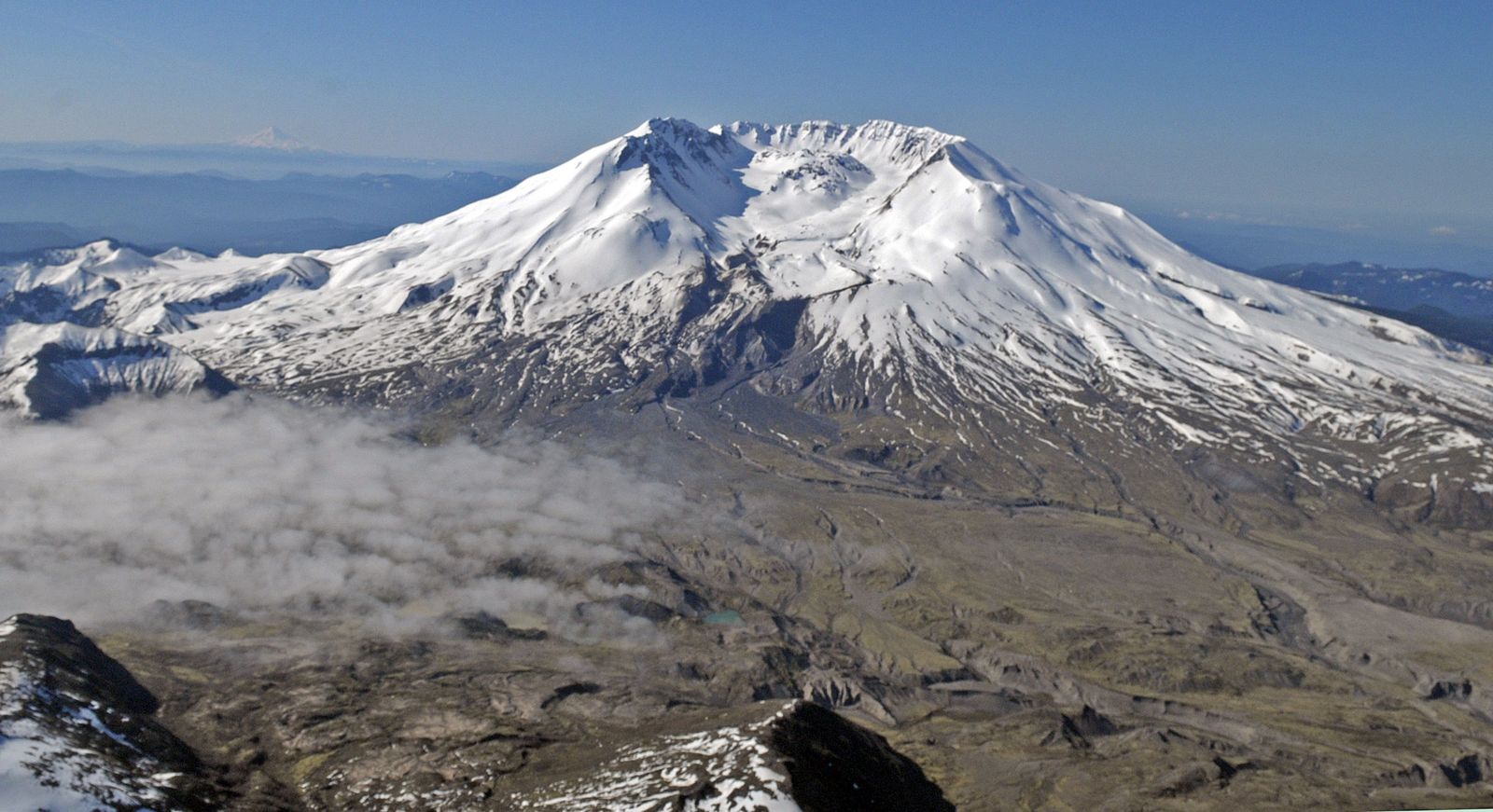
Today snow, not ash, covers Mount St. Helens, and signs of regrowth appear on the surrounding land.
Christopher Anderson The Spokesman-Review Buy this photo
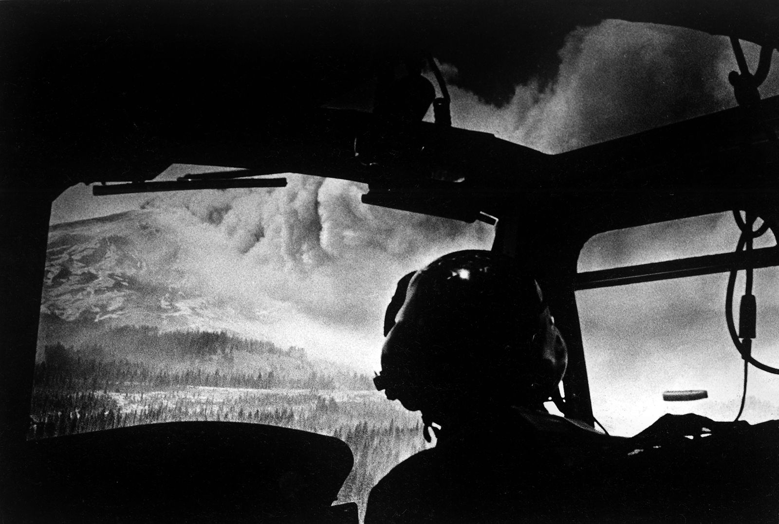
Chuck Nole is framed in a helicopter windshield as the plume spreads during a search and rescue mission in May 1980.
Christopher Anderson The Spokesman-Review
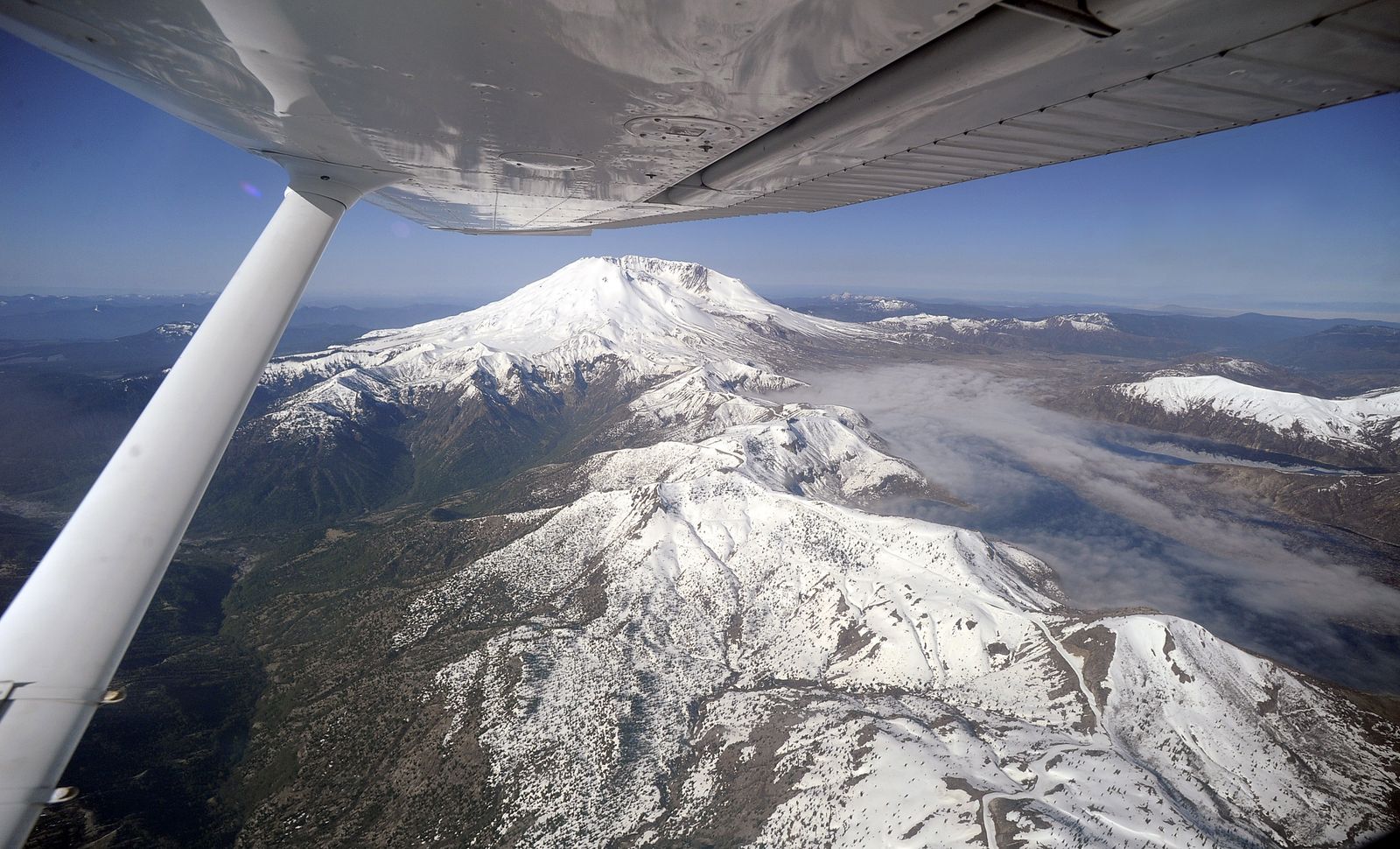
An aerial view of present-day Mount St. Helens shows ground fog covering Spirit Lake, at right.
Christopher Anderson The Spokesman-Review Buy this photo
Shattered timber and a deep layer of ash and mud cover the landscape one year after the eruption.
Christopher Anderson The Spokesman-Review Buy this photo
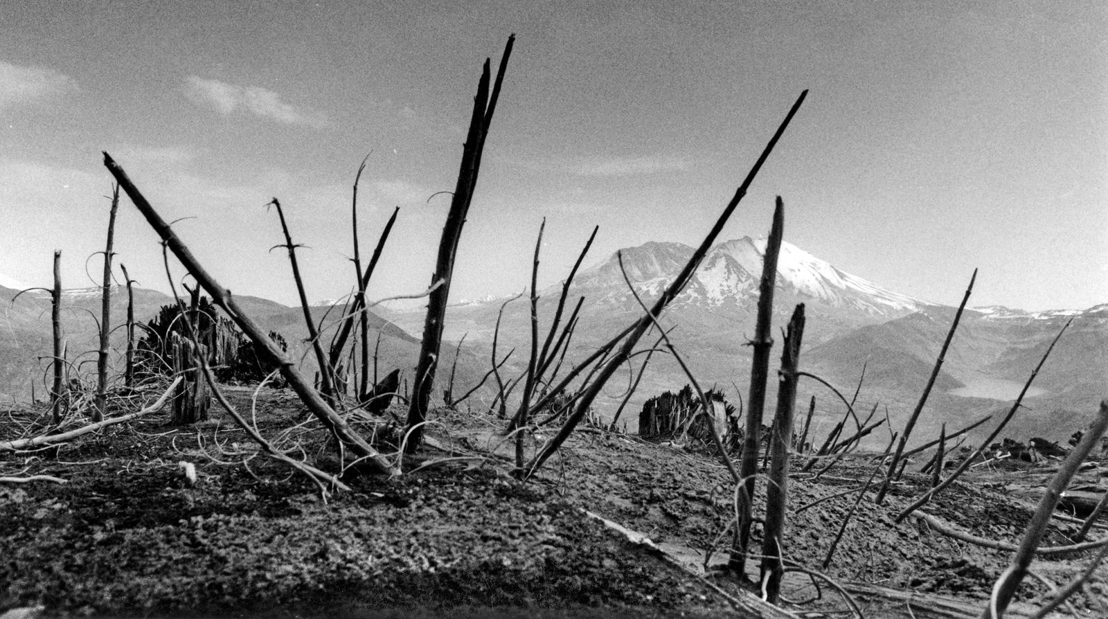
Thirty years of weather has bleached the remains of 200 square miles of old-growth timber blown down by the eruption.
Christopher Anderson The Spokesman-Review Buy this photo
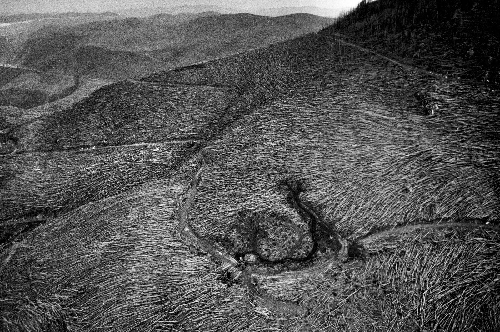
The eruption unleashed a wave of gas and energy, destroying an estimated 200 square miles of forestland.
Christopher Anderson The Spokesman-Review Buy this photo
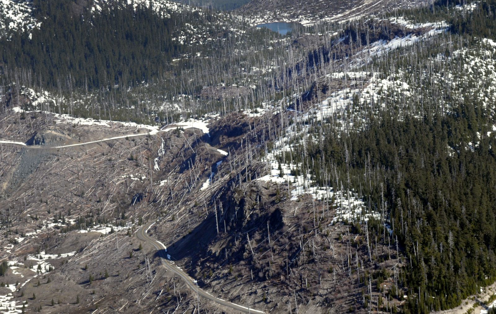
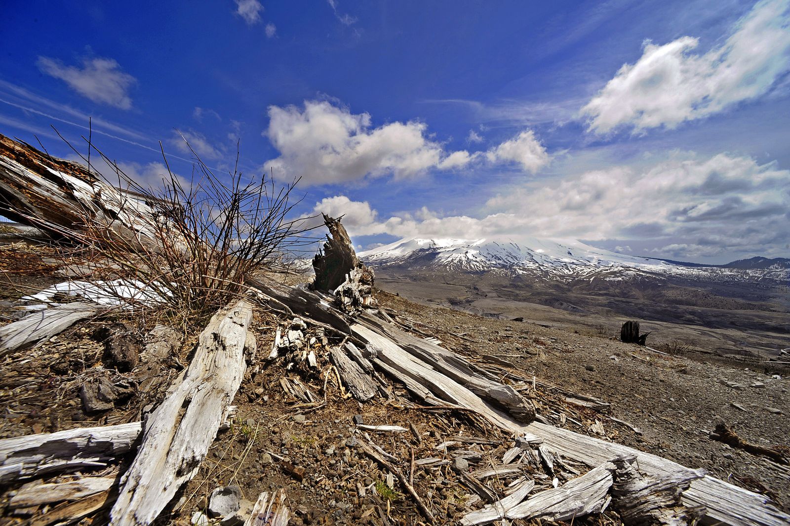
Today, some old growth still stands, while some of the blown-down timber has been harvested.
Christopher Anderson The Spokesman-Review Buy this photo
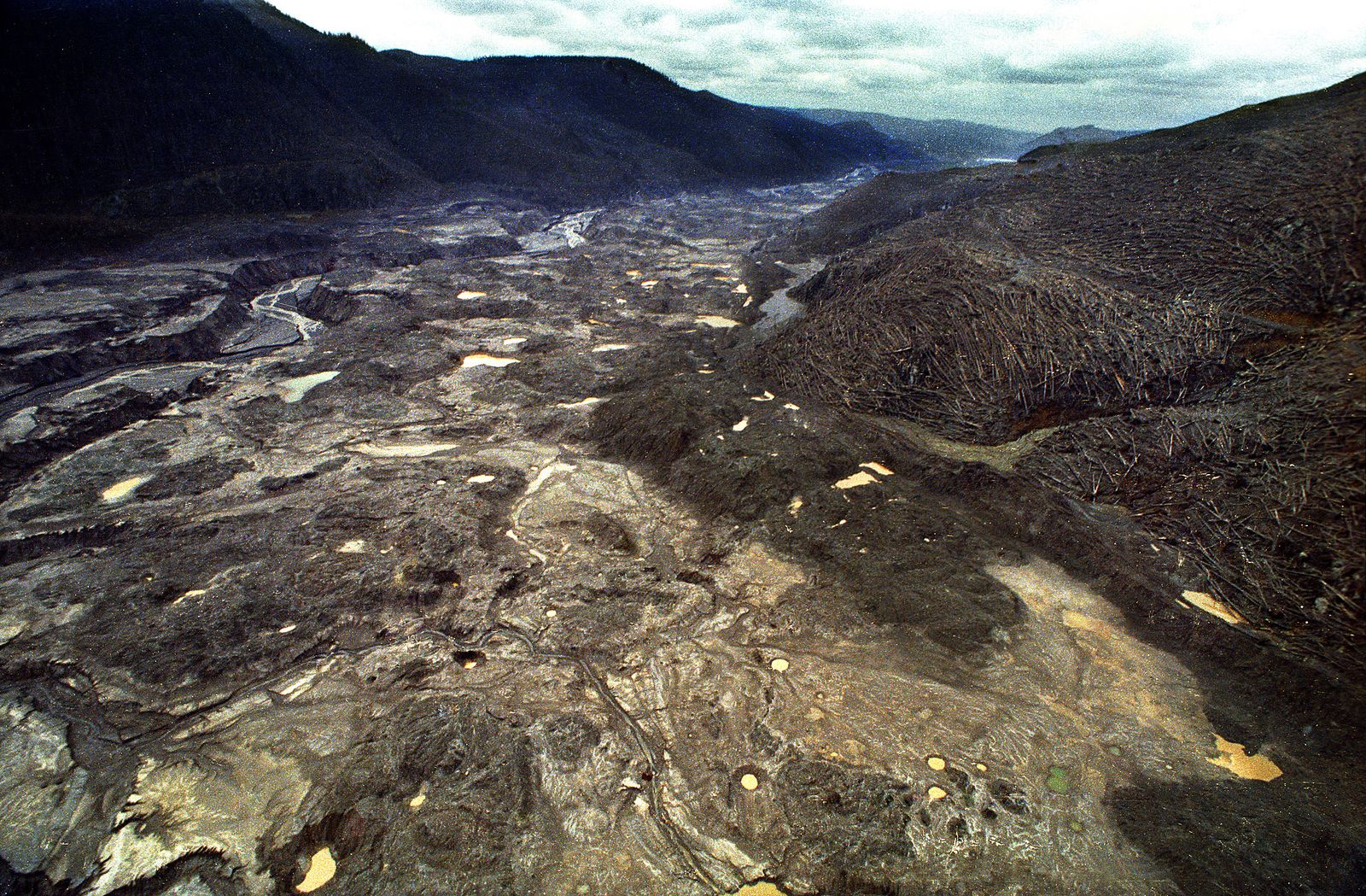
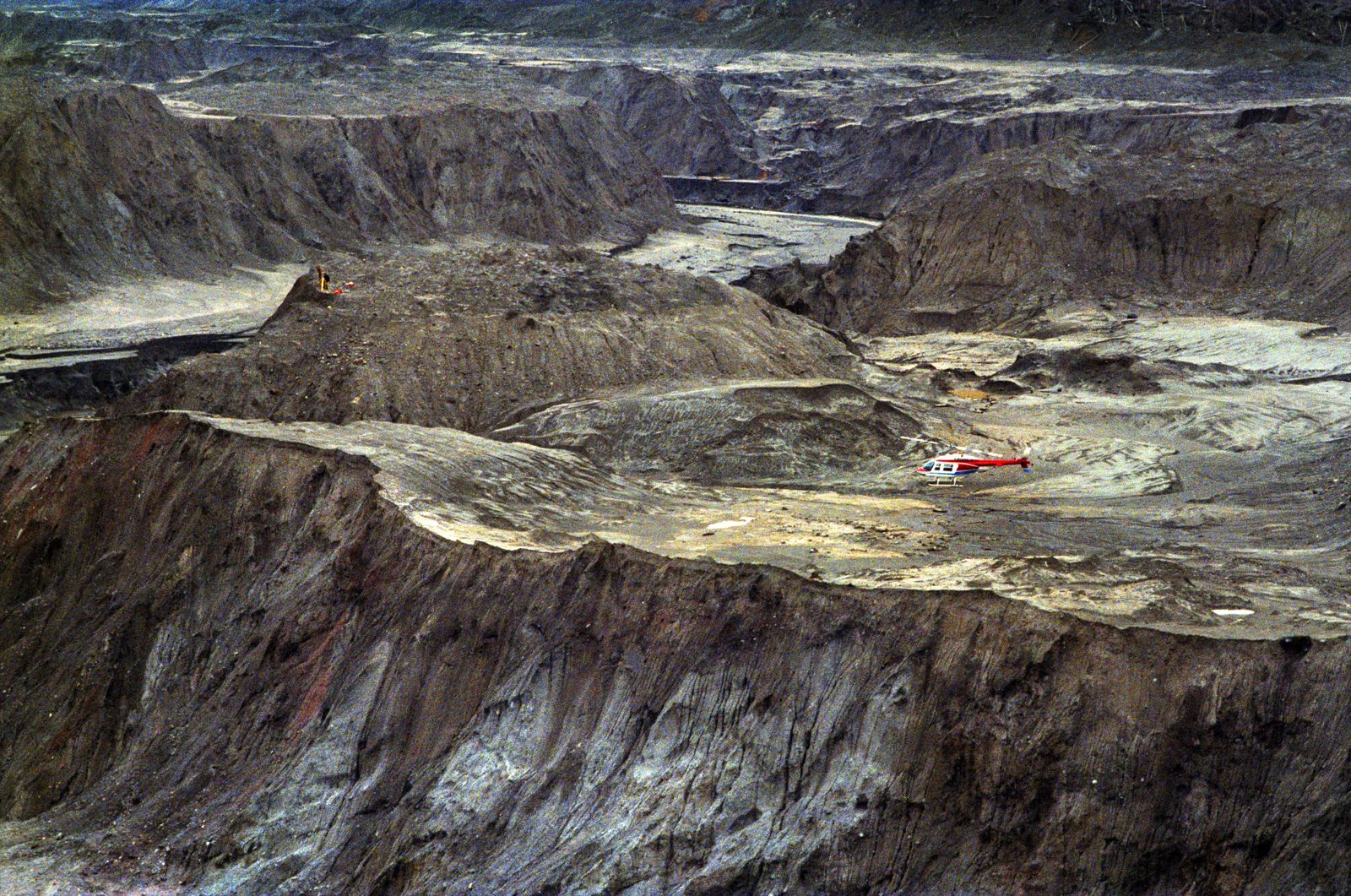
Mud and debris choke the Toutle River Basin into a mass of mud holes and erosion streams in this 1981 photo.
Christopher Anderson The Spokesman-Review Buy this photo
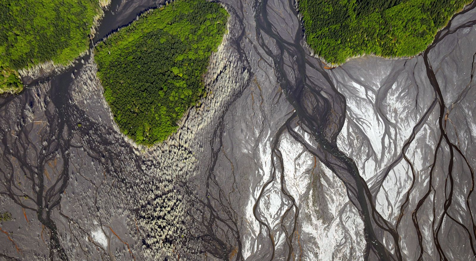
Mud and debris from the eruption choked everything in its path. Today, erosion still cuts through the debris.
Christopher Anderson The Spokesman-Review Buy this photo
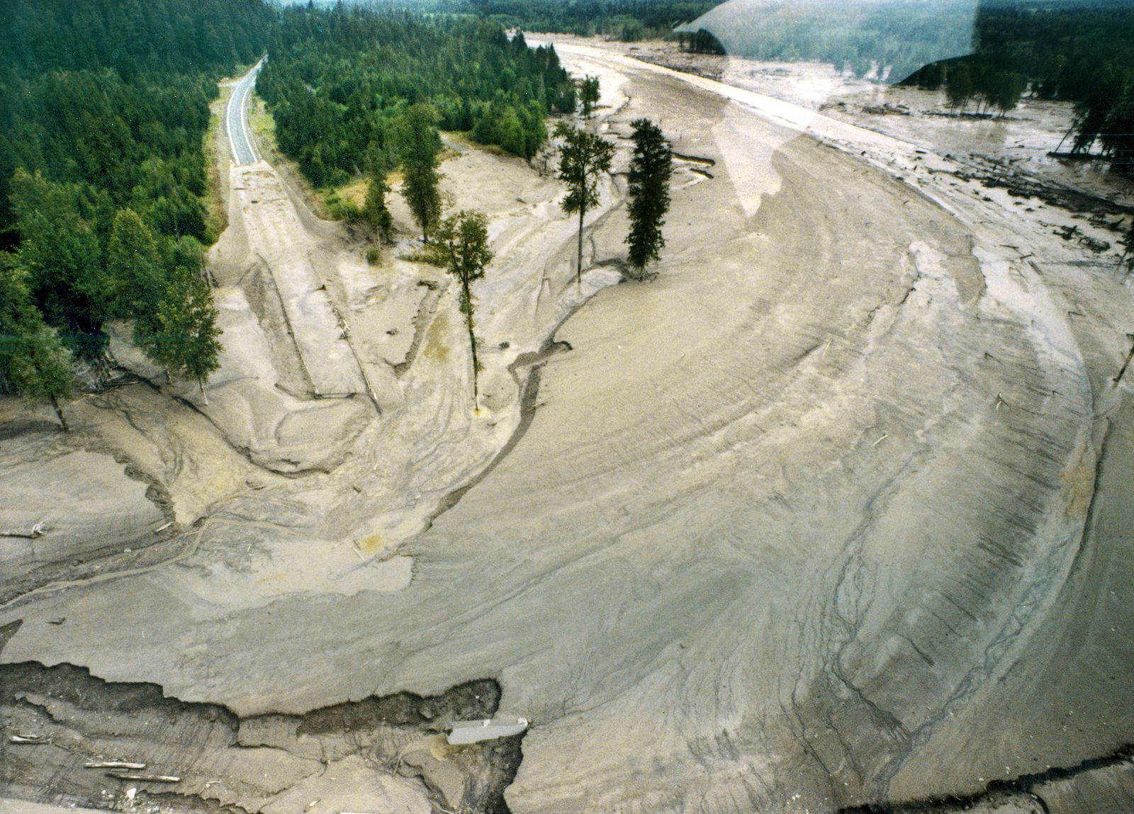
The roadway at upper left was swallowed by mud and debris in the Toutle River.
Christopher Anderson The Spokesman-Review Buy this photo
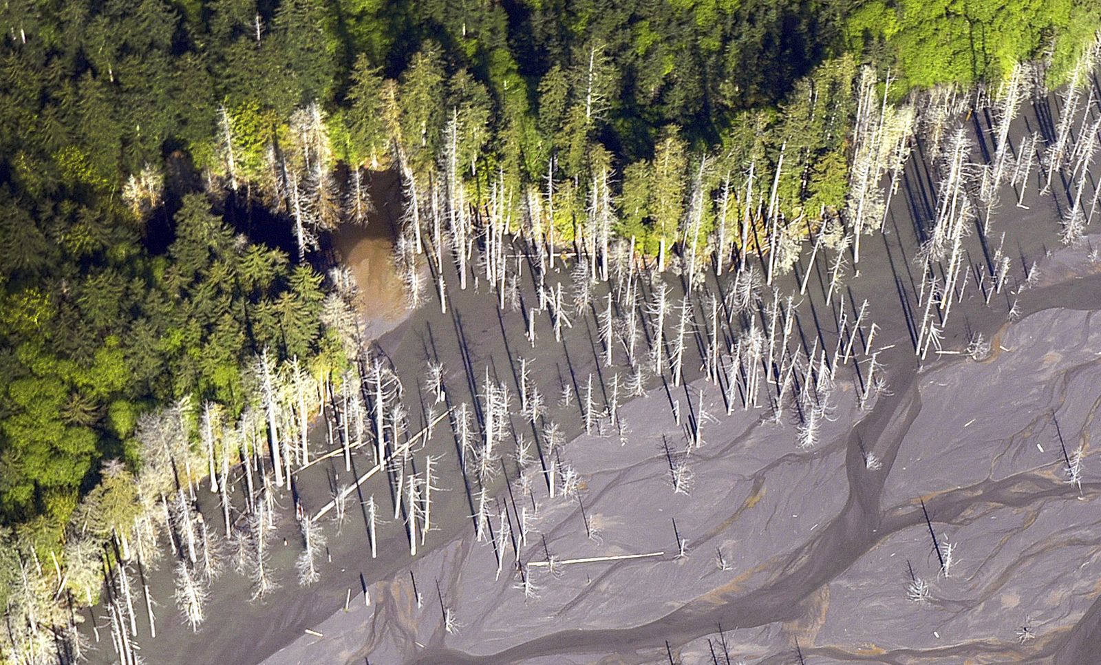
In May 2010, the mud and debris that destroyed the Toutle River drainage retain a firm grip on dead trees.
Christopher Anderson The Spokesman-Review Buy this photo
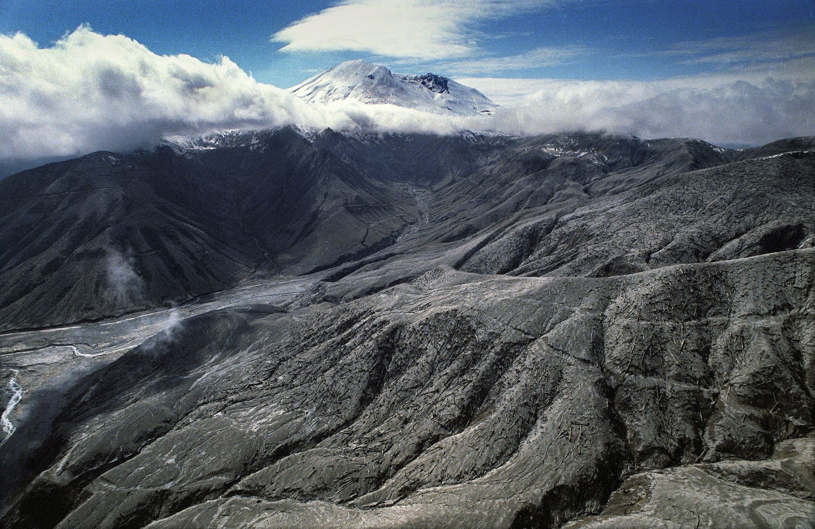
The land downstream and downhill from the crater of the mountain shows the widespread devastation a year after the eruption.
Christopher Anderson The Spokesman-Review Buy this photo
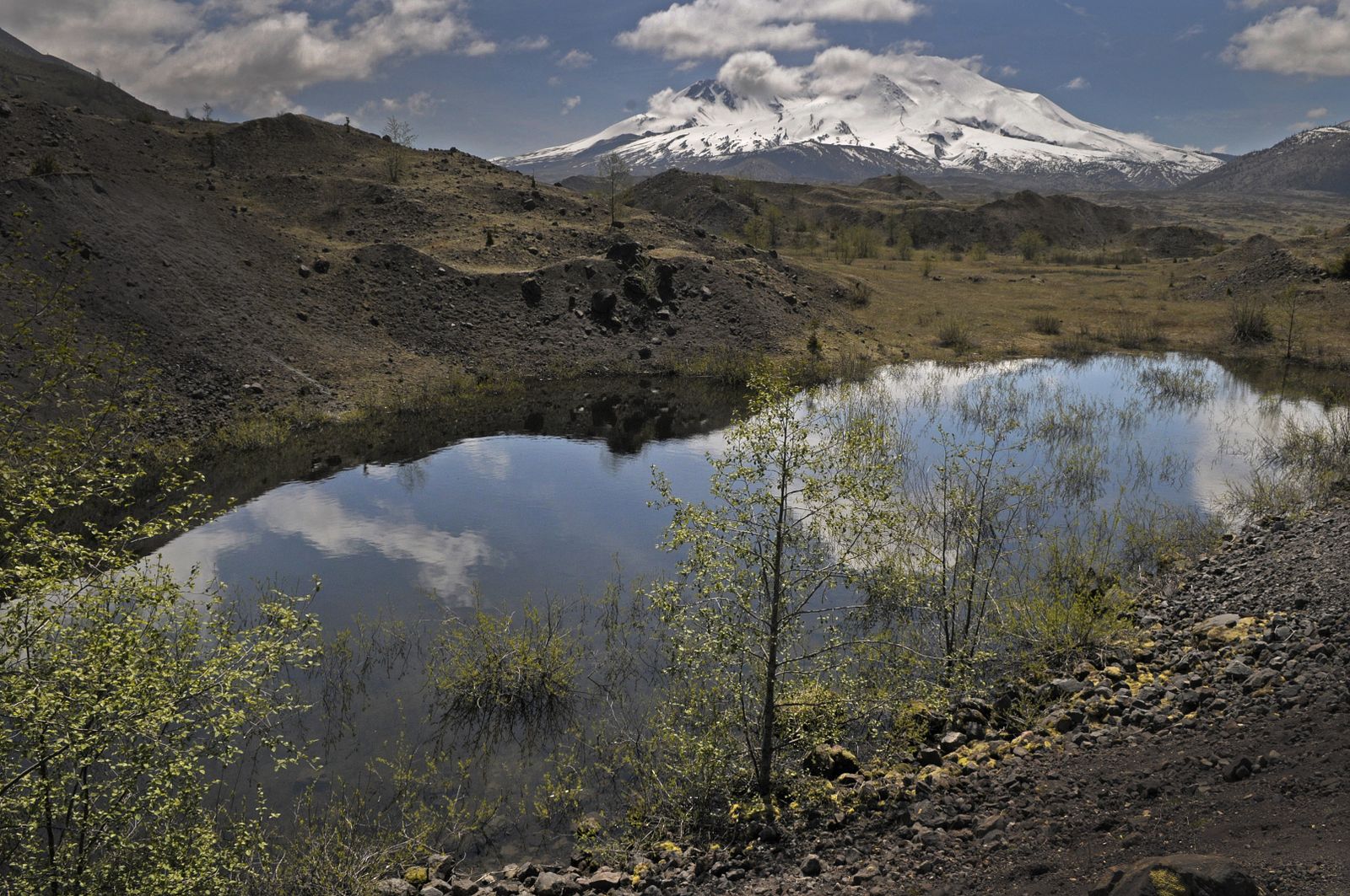
Thirty years later, small ponds populated by frogs and tadpoles have formed in the debris plain.
Christopher Anderson The Spokesman-Review Buy this photo
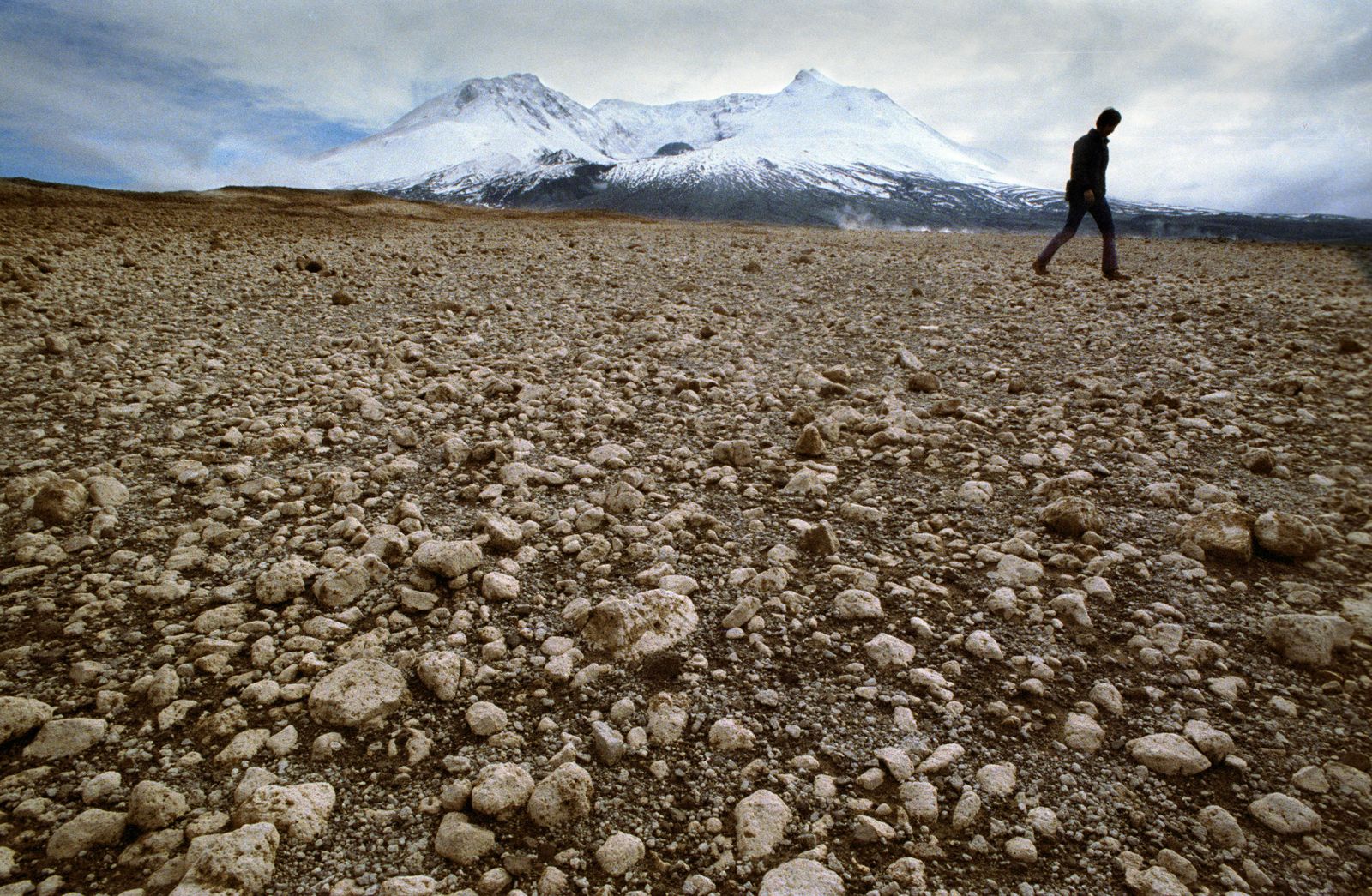
There are no signs of life a year after the eruption among pumice and debris, which was thrown miles from the crater.
Christopher Anderson The Spokesman-Review Buy this photo
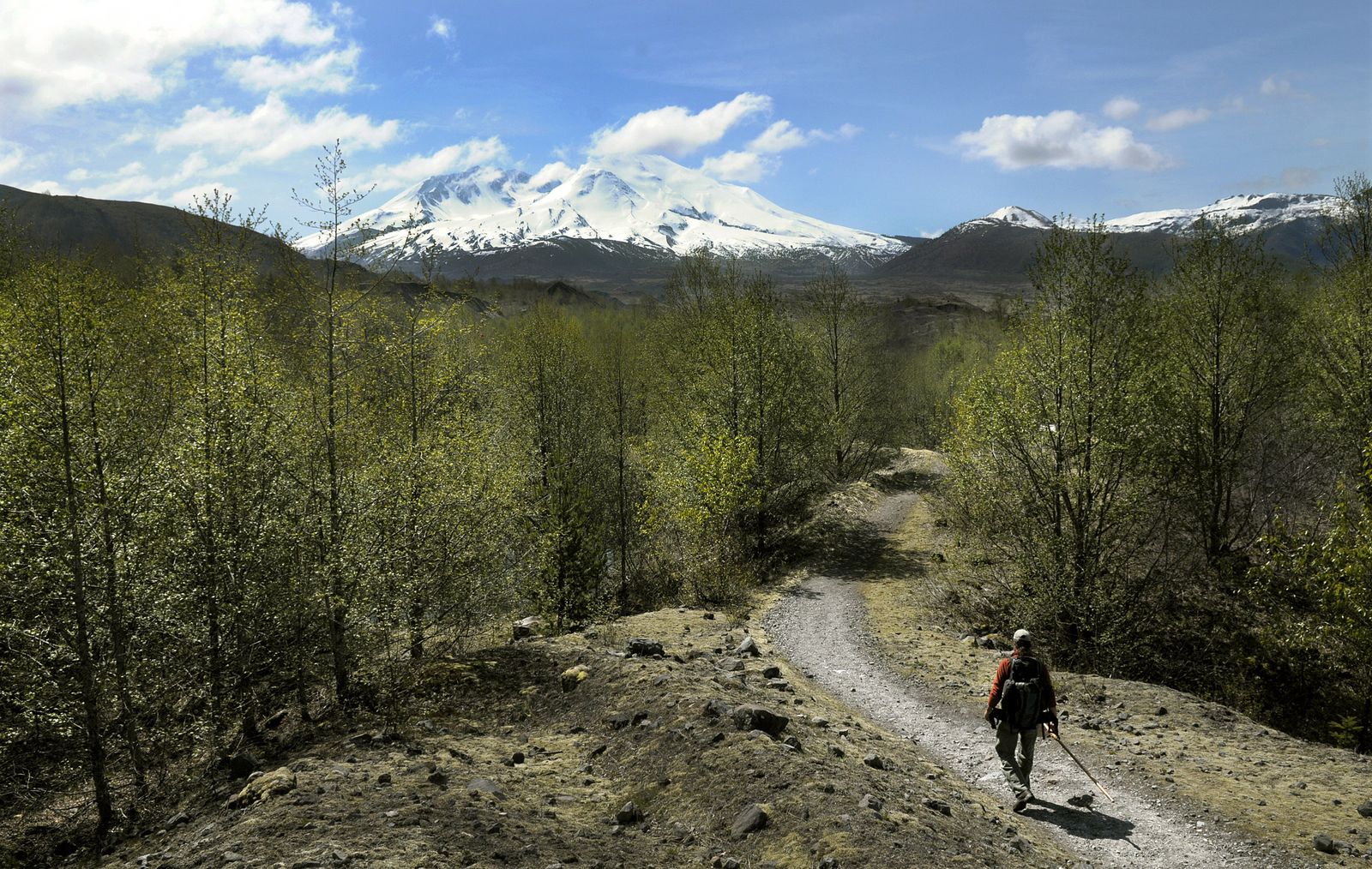
In May 2010, U.S. Forest Service ecologist Charlie Crisafulli hikes the hummocks that were formed when the mountain blew.
Christopher Anderson The Spokesman-Review Buy this photo
A year after the eruption, runoff water cuts channels in the mud, estimated to be hundreds of feet deep in places.
Christopher Anderson The Spokesman-Review Buy this photo
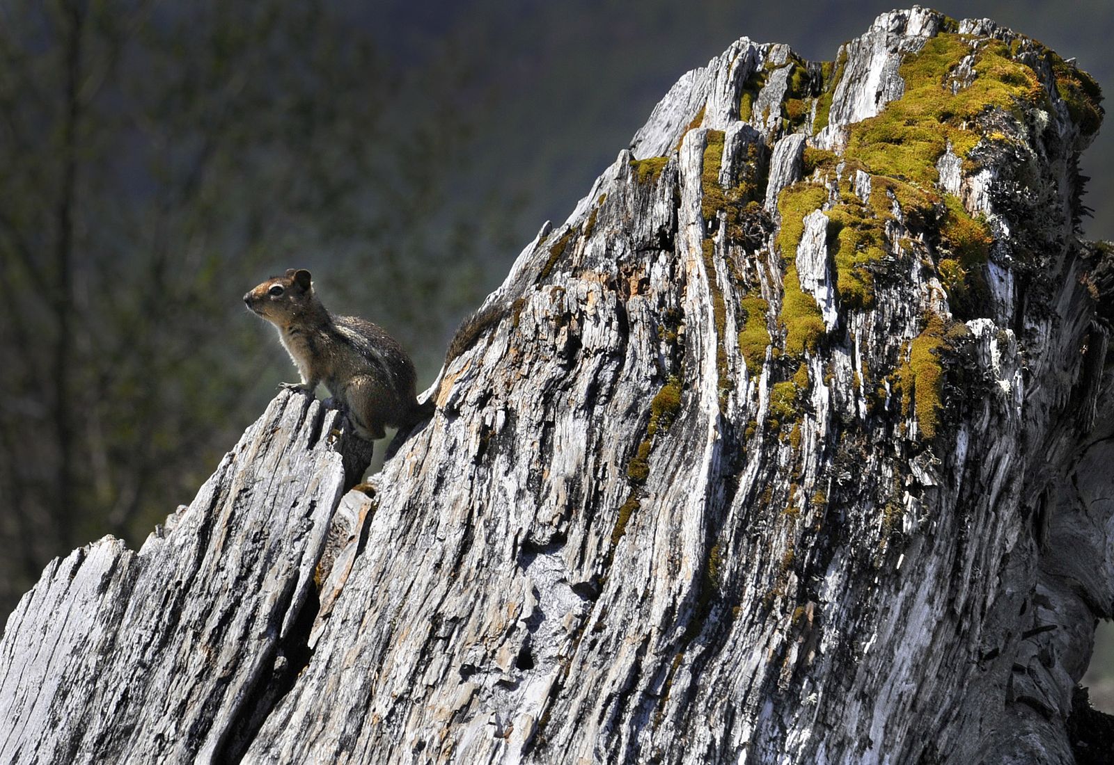
Today, small animals have returned to the area, along with beavers, amphibians and birds that nest in the blown-down forest.
Christopher Anderson The Spokesman-Review Buy this photo
Share on Social Media